Back
to Colorado
Arizona, Utah, New Mexico, Colorado
Travels from Las
Vegas through Arizona to Colorado: November
6 to November 13
(Pictures are
thumbnails. Click on them for a larger view. You may click on the subjects
listed to go directly to them.)
Subjects:
Las Vegas
Hoover Dam
Phoenix
Flagstaff
Oak Creek Canyon
Montezuma Castle
Grand Canyon
Meteor Crater
Petrified Forest
Canyon de Chelly
Four Corners
Hovenweep
Valley of the Gods
Mesa Verde
Wolf Creek
The
Rich Odyssey continued through October and November with lots of fun along the west coast of
California and onward during our return trek to Colorado. We are now in
Colorado planning our upcoming Around the World Odyssey Part II. Keep
checking this web site to keep track of us as we depart on December 1st bound
for the Panama Canal and points west.

|
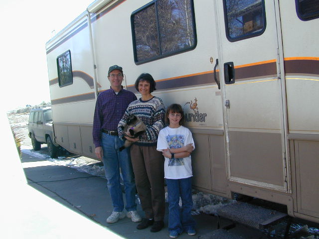
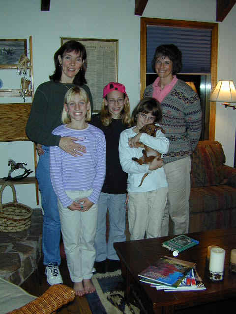
Here is the Rich Odyssey
Team in front of dependable Betty, the Bounder, our RV, at the conclusion of the first part of the
journey. Denny, Jennifer, Stephanie and Java, the cat, are happy to be
home. Betty and our Jeep are very dirty from the last leg traveling from
Cortez, CO all the way to Englewood, CO. Both will clean up fine and be
ready for more journeys in the future. But, for now, we are unloading, getting
re-organized
and finishing plans for our trip Around the World!
|
This
update consists of two parts: the first is our
West Coast
trip from Lake Oswego, OR
(Jennifer's brother's home) along the west coast to Highland, CA (Denny's
sister's home). The second update covers our return
Back to Colorado through Las
Vegas, Arizona and the remaining beautiful trip to our home in Colorado.
Please
click on both updates and the newest maps to share what we got to see and
experience. You can also click on our
Itinerary to learn about
our plans for the Rich Odyssey Around the World. As always, we have
provided you with all our
New Maps
of
the last journeys and an update on our day to day Trip Log.
Enjoy!
Back to Top
Las
Vegas
After a relative speedy
trip across the desert from Southern California to Las Vegas, we arrived after
the sun had set and were treated to some of Las Vegas' lights which you see
below. You might be interested in the fact that Denny was stopped by a
California Highway Patrolman. You see, California has speed limit signs
that are a little confusing. It says 70 MPH and then there is another sign
right after that that says 55 MPH Trucks or Autos with Trailers.
Well... what are we? Denny presumed (wrongly) that we were not a
truck or an auto with trailer and was moving along at about 68 MPH. When
the officer stopped him, he clarified the position that anybody towing anything
must travel at 55 MPH. Not many states require that. Most let RVs
just move along at the same speed as cars. Anyway, Denny just got a
warning. Thank goodness. This trip costs enough already!!
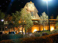
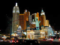
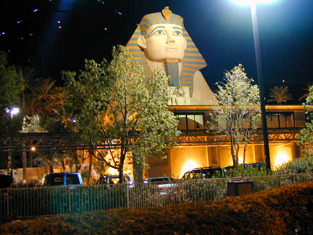
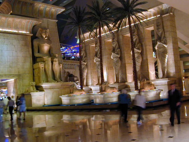
Here you see the Luxor hotel
(translated, Egypt) at night. It is amongst the coolest of those on the
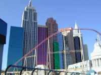
strip. Next, you can tell the picture is of New York, New York complete with the Statue
of Liberty. It looks cool from the outside, but is a little tacky once you
venture inside, which we did... to ride the roller coaster that you can
see wrapping around the 'hotel skyscrapers.' After parking Betty at Circus
Circusland (honest), we
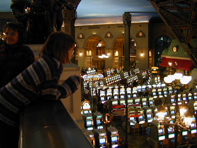
went to Paris [Casino] and up in the Eiffel Tower, a 1/2 scale model of the
real thing. Sorry, we don't have a picture of it, but you know what it
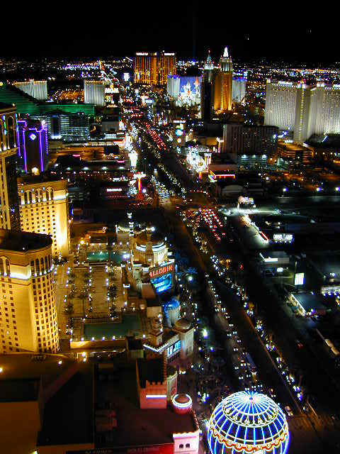
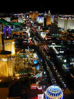
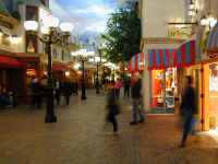
looks like anyway. This scene, along the strip, is from the Tower. You
can see some of the glitter continuing nearly a mile each direction. This is a major change since
the last time Denny visited here some 13 years ago when the strip was glittery,
but not even close to the scale it is now.
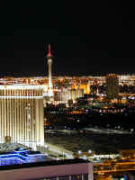
The next picture shows the tallest
tower in Las Vegas, the Stratosphere. It was built in the sixties, but ran
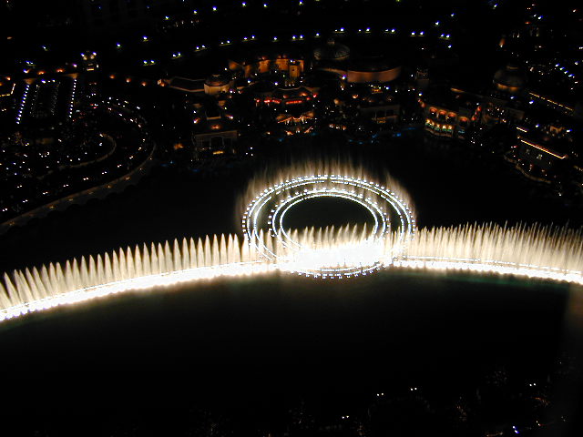
out of money, and sat ignored until recently, and is now pretty successful. The last picture,
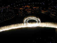
taken from the Eiffel Tower shows the performing
fountains at Bellagio, one of the fanciest.
Quite a show: variations are done every 15 minutes, accompanied by classical music and opera.

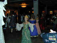
Inside the Paris casino, Stephanie
checks out the slot machines after descending the Eiffel Tower
elevator. (By the way, it is not free.) Next, you see a scene inside
the hotel which shows the shops along a Paris Boulevard. Jennifer hustles
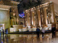
from one shop to the next. Last you see a shot inside the Luxor showing a typical, if not totally realistic, Egyptian scene.
The next day, we checked out New
York, New York and rode the Roller Coaster, which you can now clearly see wrapping around
the hotel New York buildings. Stephanie was happy because she made the 54
inch height requirement. (Actually, she is only 53 and 1/2 inches, but she
has tall shoes and thoroughly enjoyed the ride. She is a Roller Coaster fanatic.)
We walked back to our Jeep, rather than wait for the Monorail (!), and went by
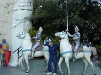
Excaliber, which is a hotel set in the days of the Crusades. Denny and Stephanie enjoy a 'ride' on the horses. We then
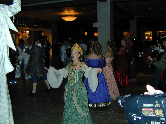
went inside the Venetian, which is absolutely first class, compared with other
hotels we visited. You see here the strolling minstrels and singers who
entertained a growing audience for some time. Jennifer window shopped at
some of their upscale shops while Denny and Stephanie were happily entertained.
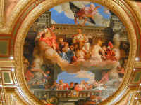
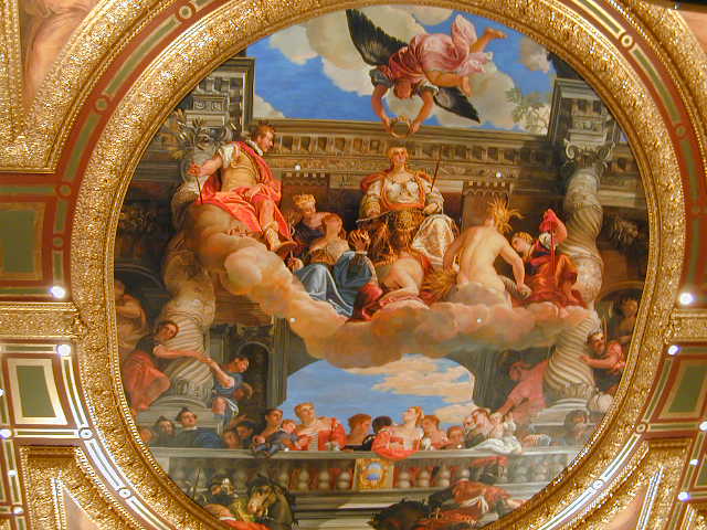
The ceiling
of the entrance to the Venetian is very elaborately painted, perhaps by a real
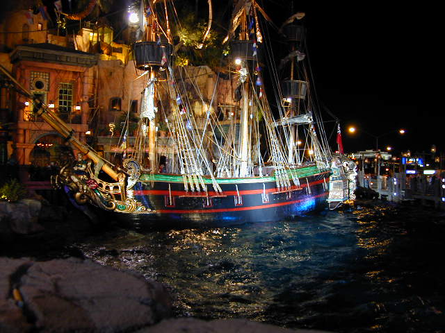
Venetian! Lastly, we walked to Treasure Island, a hotel in the Caribean
pirate motif. Every hour and a half, they present a battle between the
pirates and the British, complete with cannon, explosions, and sinking ships. You can
guess who won. It appears to be a good draw to get people inside to give
up their wages (in Lost Wages, of course). We held onto our money, except
for entertainment and meals. Las Vegas is much more now than just a
gambling city. It is real, frequently Disney Approved, entertainment.
Back to Top
Hoover
Dam

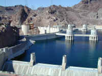
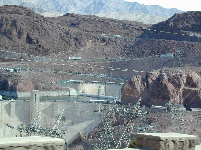
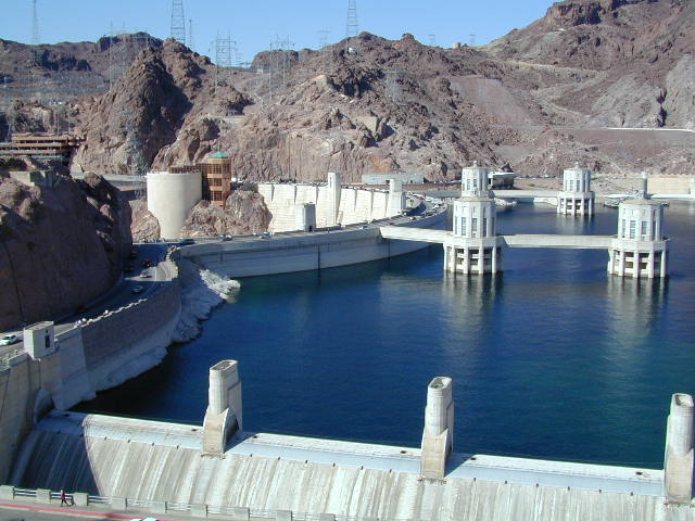
After our stay in Las Vegas, we left
Circus land, adjacent to Circus Circus and VERY noisy from the road
traffic, and began our journey across the desert to Phoenix. Along the
way, the road actually crosses Hoover Dam which creates Lake Mead. Since we had taken a tour at the Grand Coulee Dam in Washington,
we only paused long enough to enjoy the sights. The first picture is on
the approach to the dam, where you can see the traffic crossing the top of the
dam and next the spillway on the east side of the dam. There
is an identical one on the west side which is only used when Lake Mead gets too
full and the water can't all be channeled through the generating pumps and on
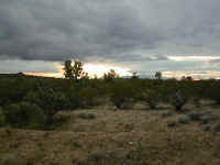
down the Colorado river. Through Arizona we followed a road called the Joshua Tree Highway, named after the trees and scenery you
see in the picture here.
Back to Top
Phoenix
We got to Phoenix, stayed in a
nice RV park and spent some time touring the city. We discovered, since we
were in Tempe, that Arizona State University and the
Phoenix Cardinals both play in Sun Devil stadium. Both days we were there,
there were games and lots of people coming and going. Sorry, we didn't
take a picture. The stadium is nestled between two hills. Hills like
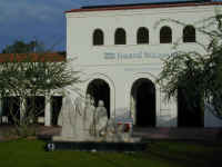
that rise up from the very flat Phoenix desert every so often. We spent a lot of
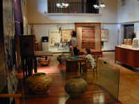
time at the Heard Museum, which gives
tribute to the 21 Indian Nations that are represented in Arizona.
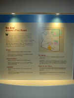
Arizona's culture owes a lot to these Native Americans. Click on the
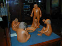
next picture for some background on the Indians. In the museum, there is
some fabulous art work. This picture depicts an early Hopi Indian
family.
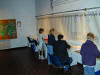
Next, Stephanie (on a computer) and Jennifer tour some of the art
work on display. There is also a lot of hands on activities for kids,
giving them an opportunity to create just like Indian kids might do.
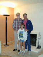
Finally, we see a picture of Rick Scrivner, an old friend of Denny's from High
School days, at his house in Phoenix. We enjoyed a nice dinner out with
him.
Back to Top
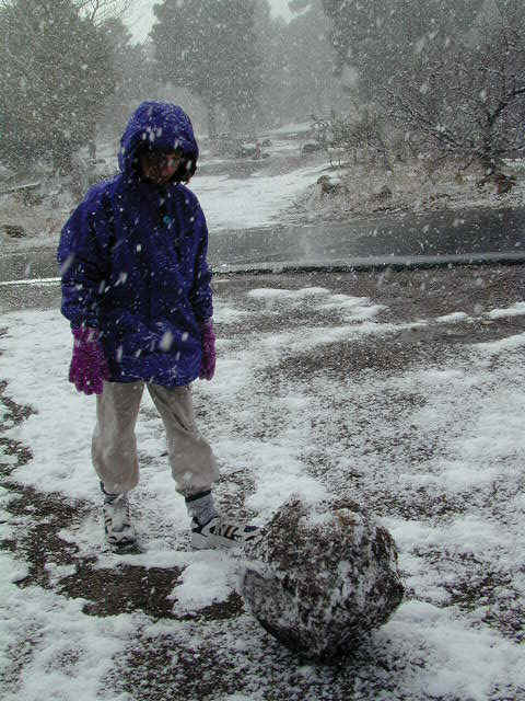
Flagstaff
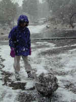

After leaving Phoenix, we proceeded to Flagstaff. As we got there, it was snowing quite a lot, as
you can see. Stephanie actually found enough snow, mixed with gravel, to
make a big snow ball. When it melted, it left a nice "moraine" we
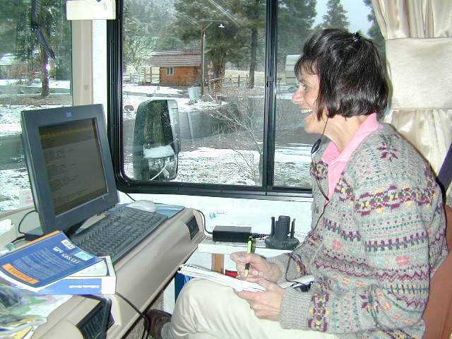
could compare to the glacial valleys we have seen. Jennifer took some time, since our cell phone internet connection was
working, to do more planning for our upcoming trip around the
world. We have a terrific travel agent, Mary Humke, at Boulder
Travel, who is helping us pull it all together. Our good friends,
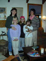
the Schmokers, recently moved from Englewood to Flagstaff, and we got an
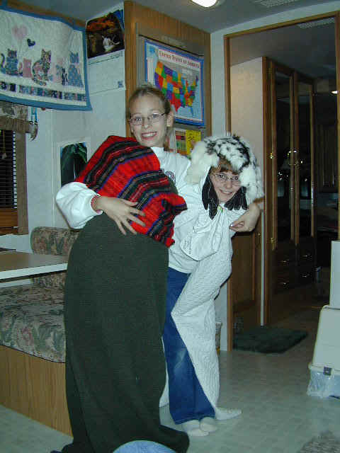
opportunity to spend some time with them. Stephanie's friend, Michelle, in
the red scarf, attended Cottonwood Creek Elementary with her and played on the
Wildcats soccer team. Mom,
Cheryl, sister, Megan, are left of Stephanie, with their new puppy Ellie, and
Jennifer. They told us that, had the dog been a male, it would be named Elway. Good
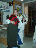
Bronco fans! Michelle visited us in our RV, and she and Stephanie put on a play in the
imaginative costumes you see here.
Back to Top
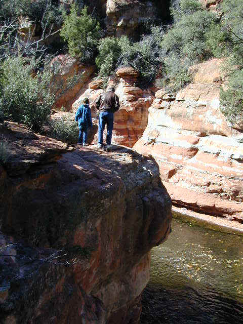
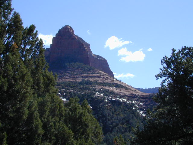
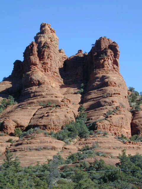
Oak
Creek Canyon
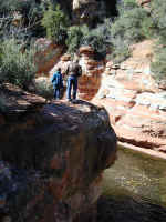
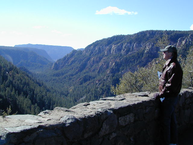
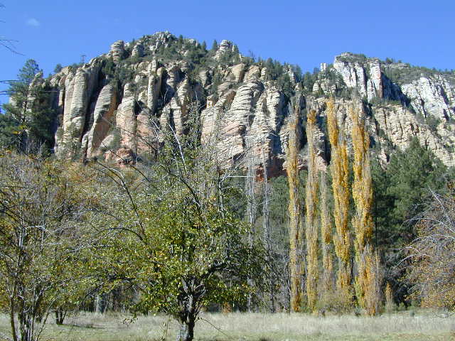
One of Arizona's treats was Oak Creek Canyon, on the drive from Flagstaff down to the lovely town,
Sedona, AZ. It was a treat and brought us back into fall
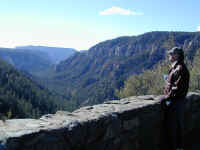
colors again. The start of Oak Creek Canyon drops
precipitously. Denny is surveying the drop and the canyon from the initial
overlook. Further on, you see a scene showing the walls of the canyon and
some remaining fall color. At a stop along the way, Denny and Steffi
survey a swimming hole, called Slide Rocks, which is very popular in summer.
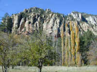
The last two
scenes show some of the spectacular Arizona scenery along the canyon.
Back to Top
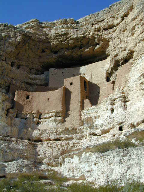
Montezuma
Castle
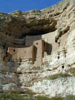
One of the fun things we have been able to
do on our Odyssey is to study maps and find numerous National Monuments or Parks that none of
us had ever heard of before. This also gives Jennifer a chance to get, yet
another, postmark stamp from the National Park Service rangers. This stop
was at Montezuma Castle, which, as you can see is an early Pueblo cliff
dwelling. This was named because the early settlers thought that the
people who lived here must have come from Mexico and were part of Montezuma's
empire. They were wrong. They were the same early Pueblo Indians,
dubbed the Anasazi (meaning Ancient Ones in the Hopi and Navajo languages) or
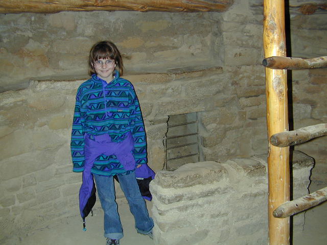
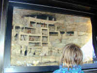
early Pueblo Indians. Stephanie studies a cutaway model of what the 'Castle' would
have looked like with people in it. Like all the other cliff dwellings,
the natives left around 1300 for reasons that are not clear. There was a drought from 1274 to 1299 (learned primarily from tree ring dating
methods), and this was probably a major factor in their departure. The last
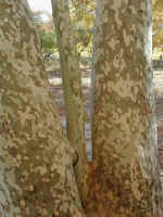
picture shows an Arizona Sycamore tree trunks, abundant at this
site. Their speckled and mottled trunks are very pretty up close.
Back to Top
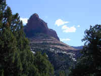
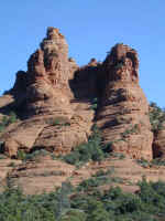
Grand
Canyon

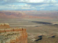
No trip to Arizona and the American Southwest would
be complete without a trip to the Grand Canyon. As you see on every license plate, Arizona IS the Grand Canyon State. We were
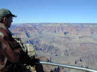
not let down. Denny has flown over the Grand Canyon in an airplane about
100 times, but never had seen it from the ground. Being able to stand in
one spot and experience the view, the silence and to be able to easily
concentrate on any one aspect of the canyon was well worth it! Just two
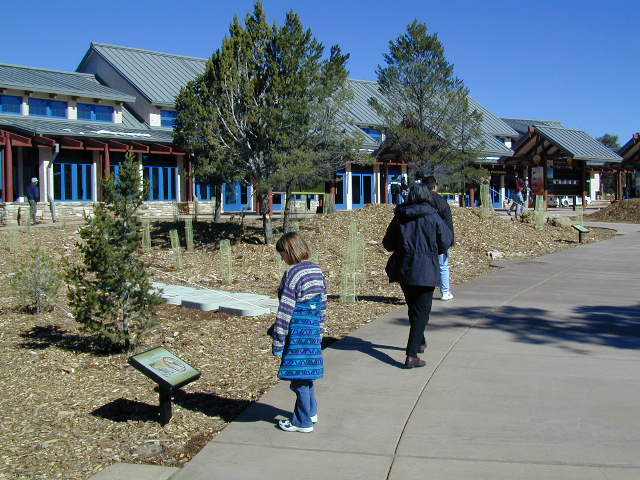
weeks before we arrived, the Park Service had completed their new Visitor's
Center, which you see in the first picture. It is well done and is a
testament to the fact that the increased entrance fees over the last three years
and fee retention by the parks
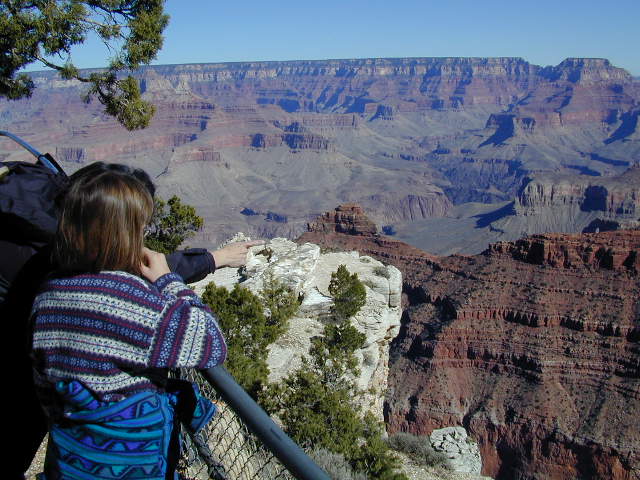
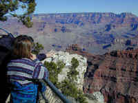
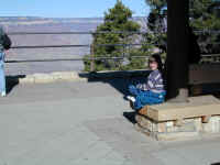
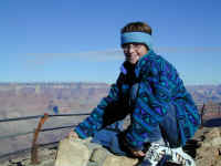
have produced great things. Stephanie and Jennifer and then Denny
experience the canyon from some of the many overlooks that abound on the South
Rim. The difference now is that you get to these spots by riding one of
the Park Service buses, or walk. We did a combination of both and it was a
good experience. You don't have to put up with traffic and cars as you
would have in the past. Even though we were there in November, there were
still a lot of people and the buses worked reasonably well.

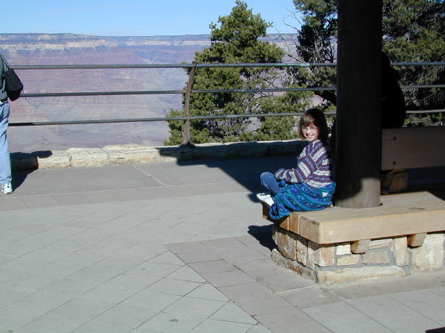
You can see
Stephanie waiting at the bus departure point for the trip to the west, dubbed
the Hermit's Rest Loop. At a stop on this loop, you can see the Inner
Gorge, which runs along the Colorado River today. If you were in a raft,
this would be all you could see most of the time, since the inner canyon is very steep and
blocks views of the outer rim. Similarly, you can't really see
much of the Colorado River when you are standing on the rim. Stephanie
poses atop one of the monuments depicting the voyage of John Wesley Powell as he
explored this canyon for the first time, by dory, in the Nineteenth Century.

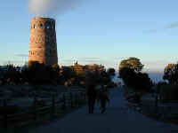
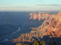
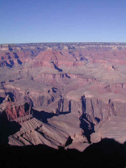
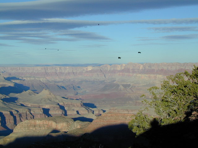
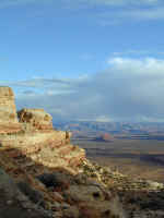
At the end of the day, we proceeded east
out of the park toward Desert View. At one of the stops, you can see some
of the many black ravens that soar over the canyon walls. Desert View has a reconstructed Watch Tower looking towards the eastern desert. And,
finally, you can easily see the Colorado River as it enters the eastern part of
the Canyon. The scenery, with the setting sun reflecting on the canyon
walls took your breath away.
Back to Top
Meteor
Crater
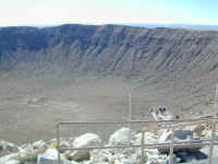
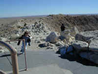
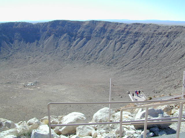
One of the more recent natural events (50,000 years
ago) was an iron-nickel meteor striking the earth in Arizona. The nearly 3
mile wide crater shown here was created when this strike occurred. Everything for
100 miles would have perished in the aftermath of this impact. We had a
good time touring the privately run visitor's center and learning more
about meteors which will strike the earth again and again in the future.
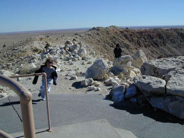
The day we were there, the wind was really blowing, especially on the rim of the
crater, as you can see as Stephanie makes her way back up the hill to the museum
and visitor's center. One interesting aspect of this crater was that it
was originally labeled (wrongly) as volcanic in origin. The scientists spent over 20 years drilling in the center of the crater to find the buried
meteor. We now know that the meteor would have disintegrated in the
initial impact and blast. Though the meteor itself vaporized, there is
plenty of evidence of the shock it caused to surrounding rock.
Back to Top
Petrified
Forest

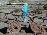

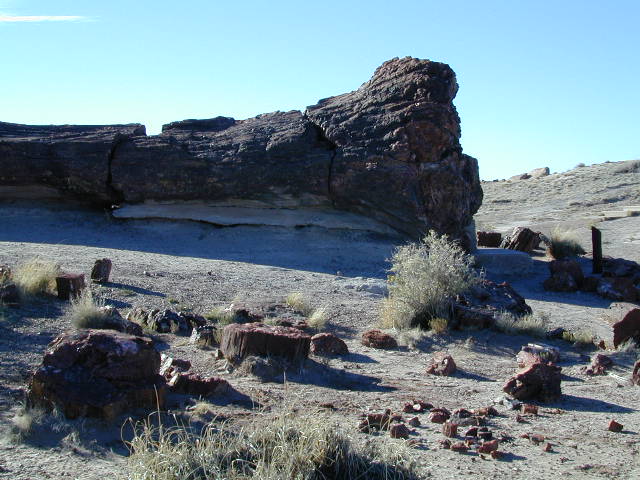
Further east of Flagstaff is the Petrified
Forest National Park. We toured the park and not only saw some great
examples of wood that had been buried and petrified, through the process of
replacing the wood with minerals, but also some very fabulous scenery. The
first picture is of an old petrified tree called Old Faithful. It was
struck by lightning in the 1970s and had to be repaired. Next, Denny walks
down the path from the visitor's center which shows many examples of beautiful
petrified wood. You can buy petrified wood at numerous gift shops, but it
comes from areas outside the park: only 10% of the total in the area is within
park boundaries. Just north
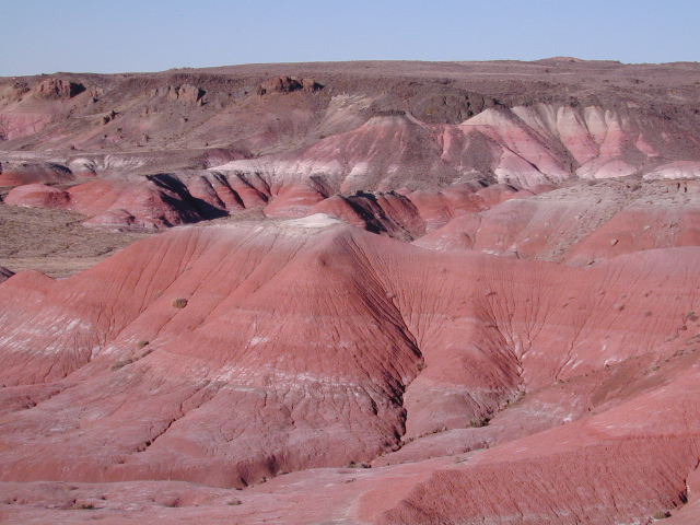
of the Petrified Forest is an area called the Painted Desert. You can see
why it is called that in the next picture. It appears as if a giant artist
has just taken large paint brushes and stroked across the desert with paints of
pink, red, gray, blue, white, black and green. Quite spectacular.
Back to Top
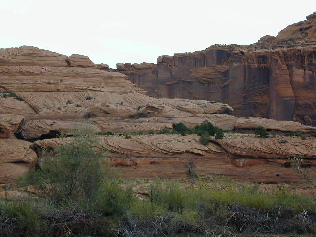
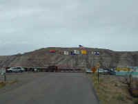
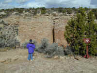
Canyon
de Chelly
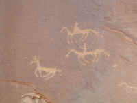
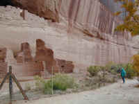
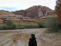
Another example of a National Monument we
(except J) had never heard of is Canyon de Chelly (pronounced d'Shay) in eastern Arizona. It is another example of
culture from early Pueblo people, dubbed the Anasazi, who lived in the canyon
from 200 to 1300 AD. About 150 Navajo still live there in the summer only
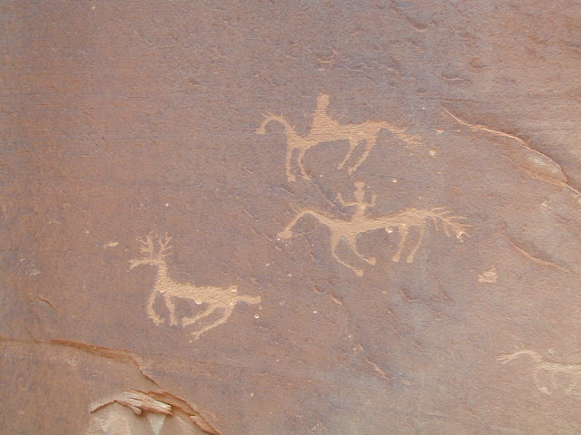
as it gets well below zero in the winter. The first picture
shows petroglyphs (rock carvings) from the Navajo people in the 1800s after they
acquired horses, which were introduced by the Spanish to the area after
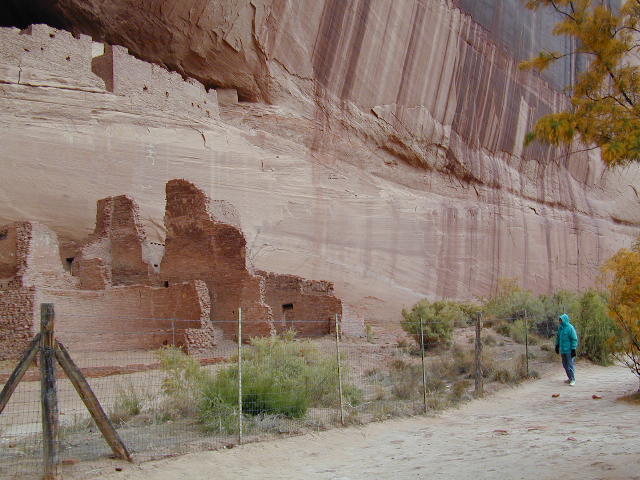
1540. The next picture is of White House Ruins, probably the most famous
of those in the Canyon. It is named after remaining white paint covering
the plaster on in
the upper floors. The floor of the canyon is river mud, sand and dirt, and you can
only go up the canyon floor in a 4X4 with a Navajo Indian guide. Without a
guide you would be limited to the overlooks from roads
along the rim of the canyon and a hiking train to White House ruin. We
saw much, much more.
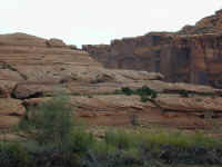
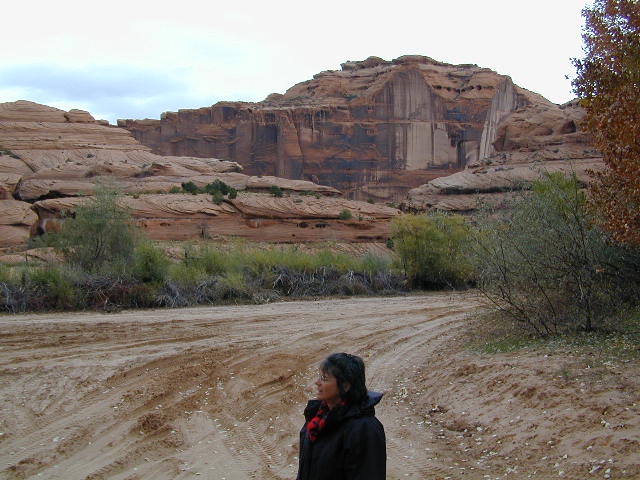
Next you
can see a picture of the erosion, wind and water, that has shaped the canyon
over the years. The Navajo Indians in this area are very poor. This
picture of one of their houses actually shows a home that is more substantial
than most, on lands which have spectacular formations and vistas.
Back to Top
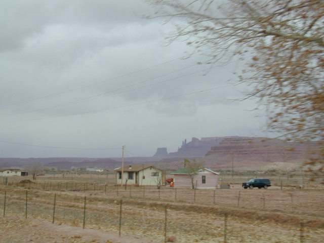
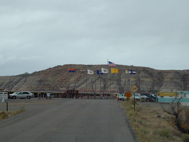
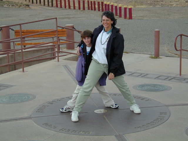
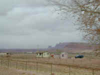
Four
Corners
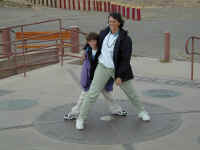
On the way to Colorado, US highway 160 goes
right by the Four Corners area, the only area in the country where four states
come together. The last time Denny visited this place in the 1960s, all
there was was a marker showing the spot. Now the Navajos have made a great
tourist area out of this surveying point. There is a $2 per head entrance
fee and many stalls are around to sell Indian crafts and art work. We were
there on a very cold and gray day and there were very few people present,
tourists or Indians. Jennifer and Stephanie have fun straddling all four
states at one time. Stephanie was very excited because this was the first
time she had been back to Colorado since leaving last May. She was anxious
to complete the journey back through Colorado to Denver. We did squeeze in
a side trip into New Mexico to see Ship Rock, a very large rock formation rising
well into the sky.
Back to Top
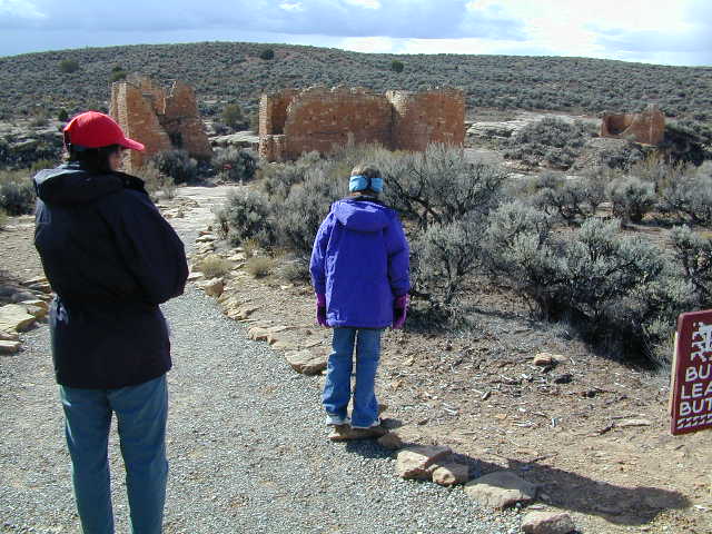
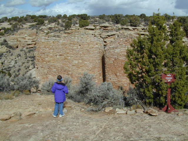
Hovenweep

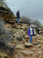
After settling in at Cortez, CO, we studied
the map again and discovered Hovenweep National Monument. This is
another monument in testimony to the ancient Pueblo, or Anasazi, Indians who
lived here from 500 AD until 1300 AD when they abruptly left. The building
of the dwellings took place from 1200 to 1300, just as it did in other parts of
the area. We took a long hike around the canyon that marks these
dwellings. The name Hovenweep, was given by an early explorer meaning
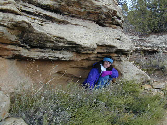
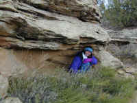
"deserted canyon" in the Hopi or Navajo language. Stephanie enjoyed checking out the dwellings, here
looking at one called Twin Towers. She especially liked hiking and
climbing on the abundant rocks, however. You can see her hiding under a
rock overhang on our hike. As with many of the NPS sites, much of the history is
lying around you, unexcavated: Jennifer found a pottery shard, thinking it was a
painted rock, and was told to return it to where she found it! She did.
Back to Top
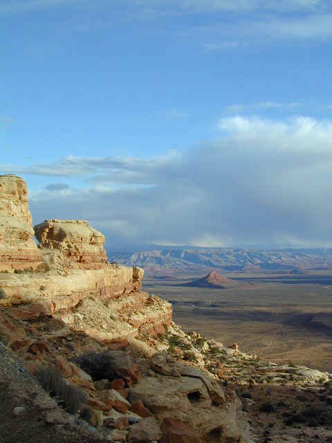
Valley
of the Gods
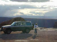
We continued from Hovenweep into
Utah to get a view of the Valley of the Gods, a part of the larger Monument
Valley. The scenery was gorgeous, and we took many pictures with our
digital camera ('film' is free, so we do take a lot of pictures!).
Here you see our jeep on a plateau at about 6,600 feet ASL. We then
proceeded down the very steep cliff (yes, there is a gravel road, but RVs and
trucks are NOT recommended) to the valley you see below which is at about 5,200
feet ASL, a 1,400 foot drop. The country is really an eyeful and we will
come back, especially since it is relatively close to Denver.
Back to Top
Mesa
Verde
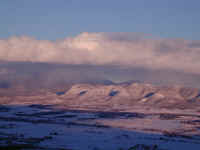
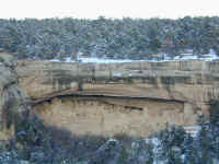
We certainly HAD heard of Mesa Verde,
and it was one of the spots we eagerly looked forward to visiting. There
had been snow in the area making the viewing
all the more spectacular. This summer, we had heard of the huge fires that had
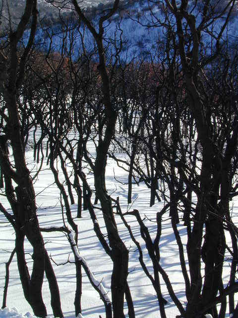
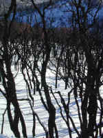
plagued not only Montana but Mesa Verde as well. There are a lot of very
black Mesquite and Pinion Pine trees, but Mother Nature will be working hard
next spring to recover. This will not take as long as Yellowstone to get
back to its original state. In the meantime, the contrast of the very
black trees against the very white new snow was quite something. Jennifer
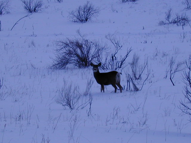
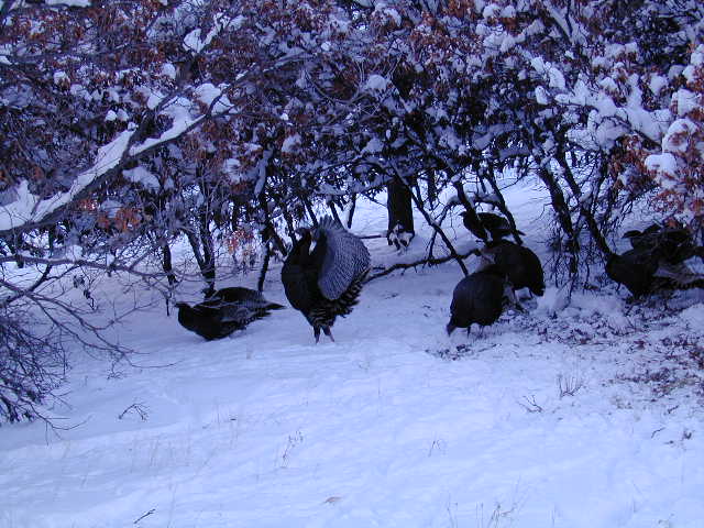
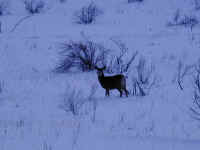
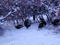
probably took about 100 pictures of this... here is one. We saw deer
and even wild turkeys on our trip into the park. The turkeys weren't apparently
all that wild because some of them would come right up to the windows of the car
looking for a handout. The view as you climb up the steep mesa is wonderful, especially with snow showers still going on.
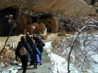

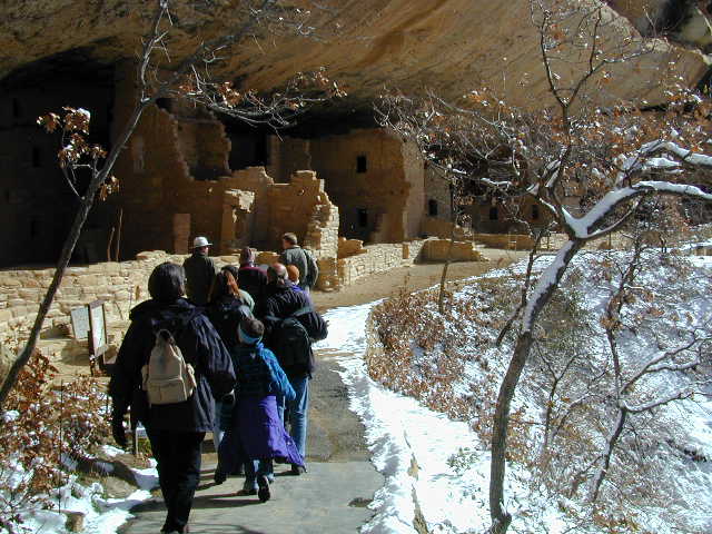
At the main visitor's center and museum,
there is a spectacular ruin called Spruce Tree House. With a ranger, you
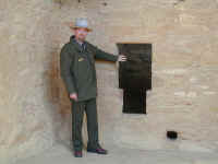
can visit the ruin and actually get very close. Our ranger, Michael, was
excellent in explaining things, here showing a T shaped door, which apparently
has its heritage all the way from the early Toltecs of Mexico. During the winter, the
Anasazi would place a limestone slab over the door to keep the cold out.
These early Indians had buried rooms called kivas, which they used for
ceremonies and as gathering places. We were able to climb down the ladder into
one. Stephanie is standing by the opening where fresh air would come in and
be deflected around the little rock wall to provide ventilation for the fire
that was always burning. The smoke exited out the hole in the roof where
the ladder is standing. Smoke was just one of those things that the early
Indians put up with and viewed as a cleansing.
After touring Spruce Tree House, we waited
for the snow plows to clear the upper road and then continued on to view more of
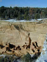
the cliff dwellings. The first is a view of the Sun Point Ruins with its
four-story square tower and the
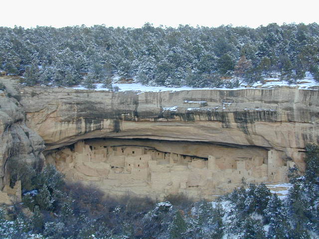
next is the very famous, Cliff Palace. The road to the top of that area is
not open in the winter so we could only view it from across the canyon.
Nonetheless, this was Stephanie's favorite!!
Back to Top
Wolf
Creek
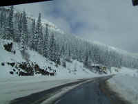
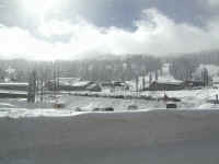
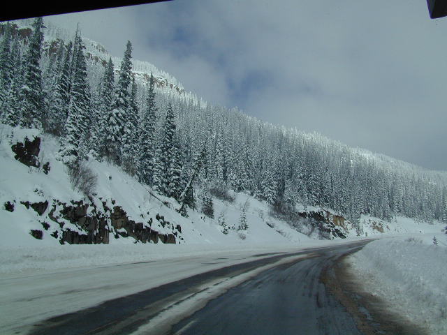
The route home along US 160 in Southern
Colorado takes you over Wolf Creek Pass. This is a very steep pass and we
were glad that the snow had come a day earlier because the roads were in pretty
good shape. Betty Bounder pulled us up and over with no problem.
Just to show that we ought to have a pretty good ski season, this is a shot of Wolf Creek Ski Area as we passed it. Unlike last year, there is not a
rock in sight and the crowds looked good, especially for a weekday in
southwestern Colorado.
Back to Top