Appalachian
Tour
Georgia, Blue Ridge Parkway, Western
Virginia, Pennsylvania, Massachusetts, New Hampshire
Travels in
Appalachian States to New Hampshire: August
7 to September 4
(Pictures are
thumbnails. Click on them for a larger view. You may click on the subjects
listed to go directly to them.)
Subjects:
Cumberland Island
Okefenokee Swamp
Chickamauga
Smokies
Biltmore Estate
Blue Ridge Parkway
Charlottesville
Shenandoah
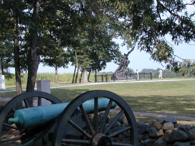
Harper's Ferry/Gettysburg
Amish Country
Crayola Factory
Poconos
United Nations
Minuteman/Lowell Parks
Portsmouth
|
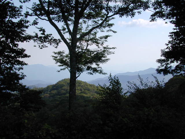
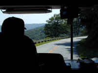
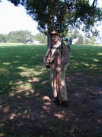
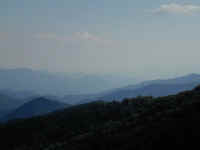
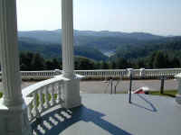
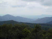
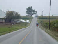
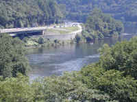
Much of this part of the
Rich Odyssey was spent traveling the beautiful Appalachian Mountains. Here
Denny is driving Betty the Bounder down the Blue Ridge Parkway. The view
is typical of those we saw. A good, but slightly narrow road, and views of
lots and lots and lots of green trees and blue ridges in the distance. You can
get a more detailed update on the Parkway in the September issue of Money
Magazine!!
|
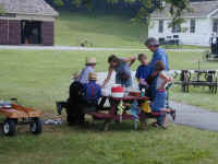
This update covers a lot of ground!! We
left Space Camp in Florida and began working our way North roughly following the
Appalachian Trail. It took a little while, but we have made it to very cool
weather! Right now, we are in cloudy, cool Portsmouth, NH on our way to
Maine and Canada.
Along the way, we have visited notable places
such as Cumberland Island National Seashore, the Okefenokee Swamp and the Unclaimed Baggage Store in Scottsboro, AL,
where Jennifer had a ball looking, but did not really find all that much to cram into
Betty the Bounder.
From there, fabulous scenery greeted us in the
Great Smoky Mountains National Park in Tennessee and North Carolina and all but
50 miles of the 469 mi. Blue Ridge Parkway National Park in North Carolina and
Virginia (which Denny hadn't known existed before this trip). We also drove through the Shenandoah
National Park in Virginia on our way to visit friends near Charlottesville, VA,
the home of Thomas Jefferson's Monticello.
Several days spent touring the battlefields at
Chickamauga/Chattanooga, Harpers' Ferry and Gettysburg gave us a new appreciation for the scope, passions and blood which
marked the American Civil War between the North and South. Dennis' business trip
to
Denver left Jennifer and Steffi by themselves to roam the Amish country and
Pocono Mountains of Pennsylvania, visit the United Nations and then travel
on to Boston where they were rejoined by the Dad, who was very glad to be
back. A visit to the Battle Road from Boston to Concord, MA
gave us a new perspective on the outbreak of the Revolutionary War, starting on
April 19, 1775. We are, however, taking a break from battlefields for a while!
We have lots of pictures and brief
descriptions of all we saw along the way. Enjoy them! Two new Road
Maps and an updated Trip
Log are also included.
|
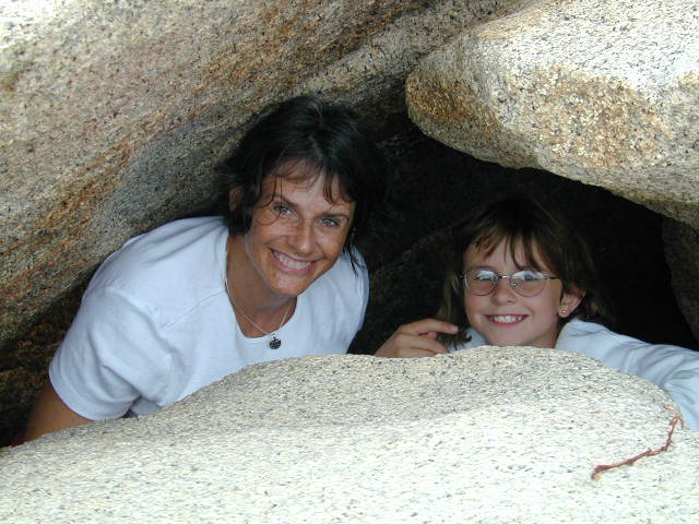
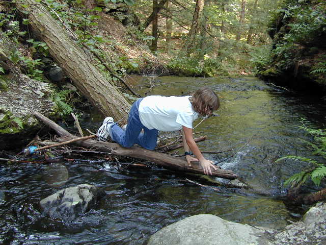
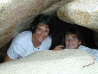
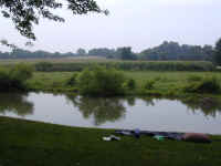
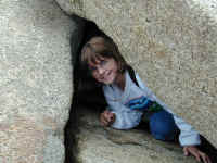
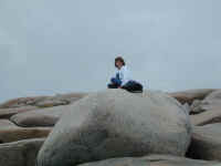
Recently, Jennifer and
Steffi had an opportunity to visit Gloucester, MA where they had a chance to
explore some of the neat rocks near the seashore. Steffi takes every
opportunity we have to climb on or crawl in and under every rock we see.
These were among the best.
|
Here we go on the start of
our Appalachian Tour starting in Florida and going north along the Appalachian
Mountains ending up in Portsmouth, NH.

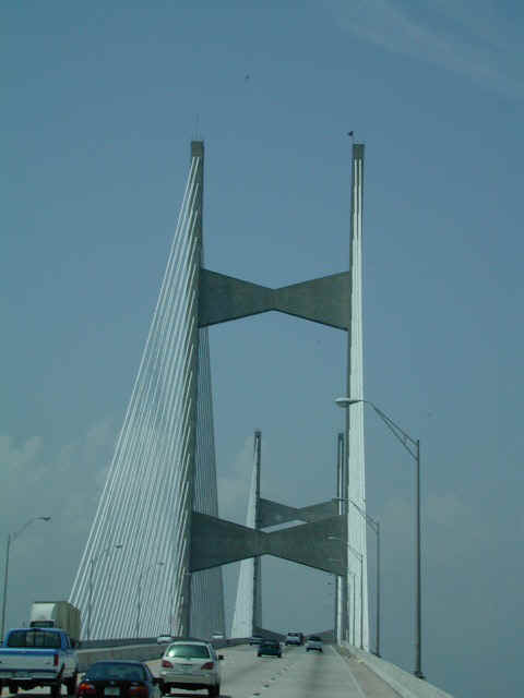
This is a new bridge on I-95 as it crosses
the large St. Johns River in Jacksonville, FL. The supporting steel
cables, with a white covering, make the bridge look exactly like enormous sailboats
gleaming in the sun, especially from a distance. We are on our way to
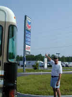
Georgia to visit the Cumberland Island National Seashore, traveling via Amelia
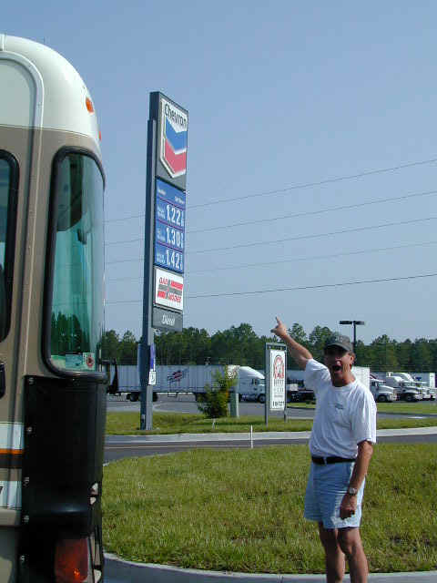
Island. After crossing
into Georgia, Denny is amazed at the gas prices. Click on the picture for
a better view of the $1.229 price for Regular Unleaded Gas!! Prices are
the best in Georgia and much worse in all of New England.
Back to Top
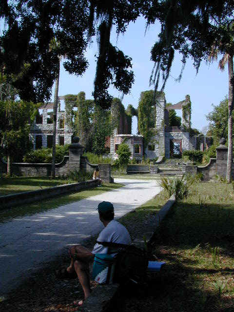
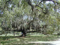
Cumberland Island

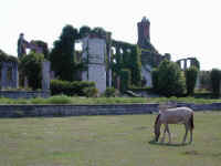
You can get to Cumberland Island only by
taking a National Park Service ferry from St. Marys, GA. Once there, you
can hike or camp. We hiked and also visited another great white sand
beach on the ocean side. The island was owned largely by the Carnegie
Family around the turn of the century. This is the remains of the large
Carnegie mansion, Dungeness, which was destroyed by fire in the 1950s before being
protected as a National Park. Denny is looking at the front, and around the
back you can see one of the many wild horses that roam the island.
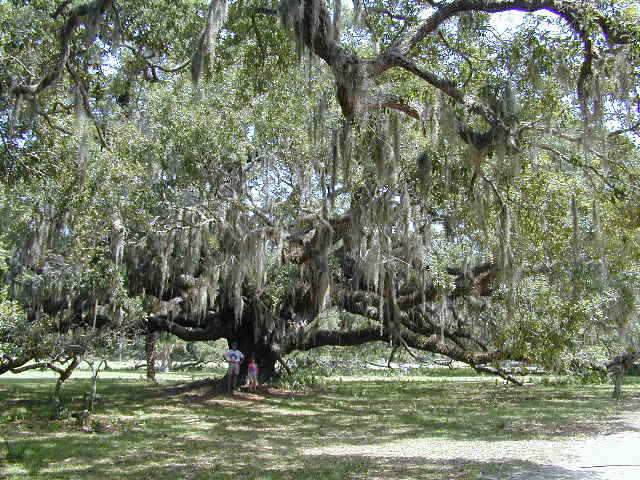
Finally, click for a larger view of Denny and Steffi standing under an 800 year
old live oak tree. The Spanish moss hanging from the tree is typical
throughout the South.
Back to Top
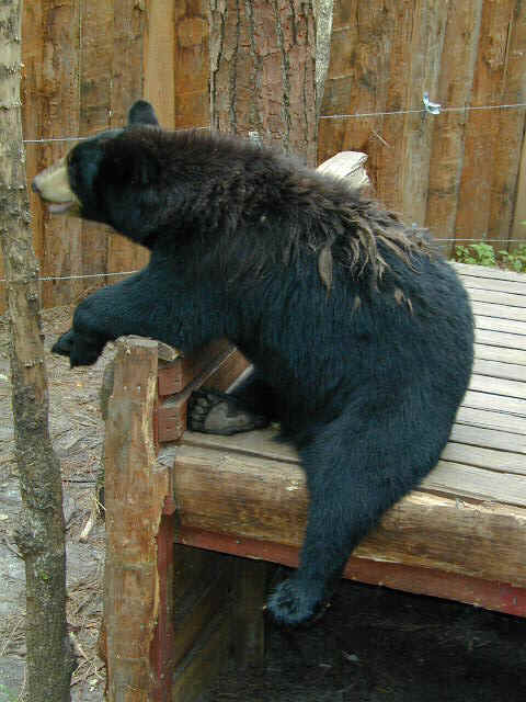
Okefenokee Swamp

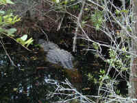
After moving on to the Okefenokee Swamp in
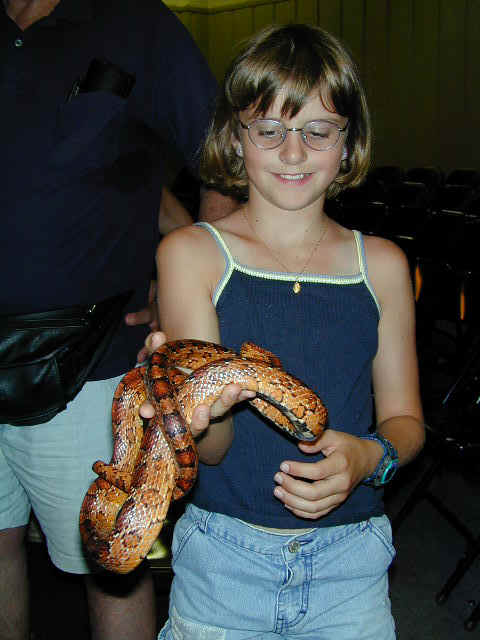
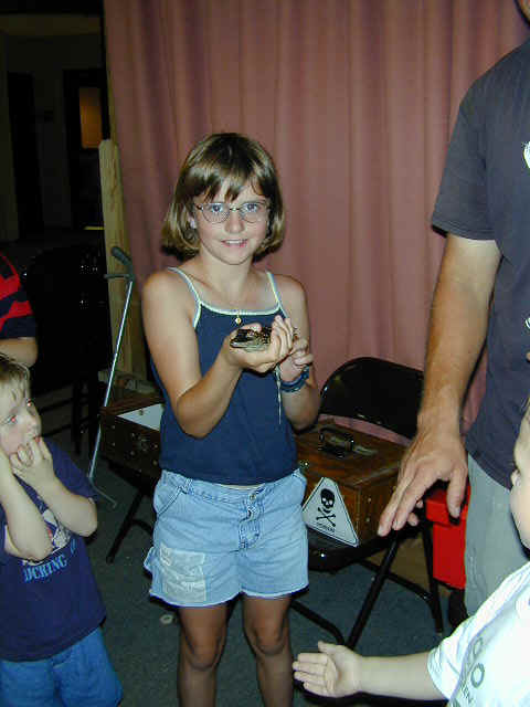
Southern Georgia, we see Stephanie holding a pretty (nonpoisonous) corn snake. She also has fun holding a baby alligator. The
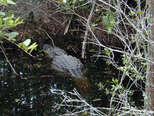
swamp is very low right now because of the drought, but we did see a large (13 ft.)
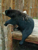
alligator resting in the swamp waters; he was locally known as Oscar. Black bears are prevalent
all over the South, and here is a nice one in one of the wildlife enclosures by
the swamp entrance. Lots of signs are around telling you NOT to feed
the bears.
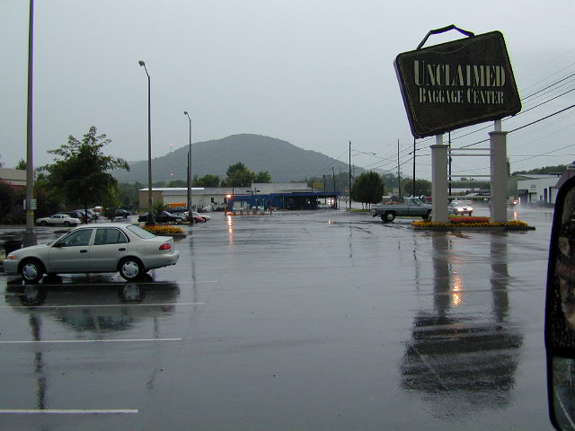
Jennifer, the ULTIMATE shopper, got
a 'fix' by traveling somewhat out of the way to the Unclaimed Baggage Center in
Scottsboro, in northern Alabama. All airlines in the world send stuff
there. This picture is taken from Betty in the parking lot after dashing
from the store at the end of a very large thunderstorm. The power
went out, but that didn't stop Jennifer from buying a few items. She
didn't get much because the RV has limited space, and we didn't need anything
anyway. If you ever need a PC or Cell Phone connection cable, though, this
place has one: check www.unclaimedbaggage.com.
Back to Top
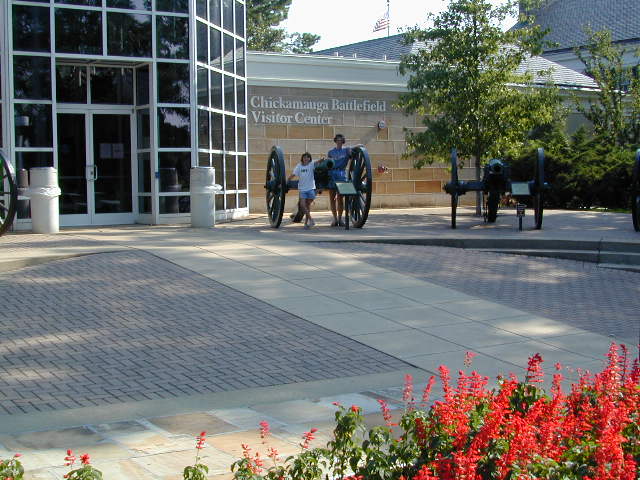
Chickamauga

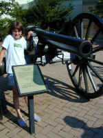
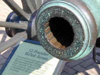
Jennifer and Steffi stand in front of the
Chickamauga Battlefield Visitors Center in Northwest Georgia just south of
Chattanooga, TN. Steffi stands in front of one of the many cannon used in
the Civil War. This cannon could fire a cannon ball about three
miles! Note the rifling in the next picture (the curved grooves, which
makes the cannon ball fly spin and fly straight, just like a rifle
bullet). Kids, please note that the plural of cannon is also
cannon!! Steffi passed that on her spelling test! The last picture
is of a young Park Service worker dressed as a Confederate soldier would have
looked (IF he had been resupplied). He gave a talk and a good perspective
that clearly showed the Civil War was about much more than slavery. States
rights and fair taxation were a much bigger issue for the South, and keeping the
Union united was the biggest issue for the North. One trivia
point... Did you know that Lincoln's famous Emancipation Proclamation freed slaves
only in the Southern States, not the North!!
Back to Top
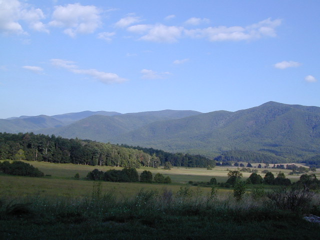
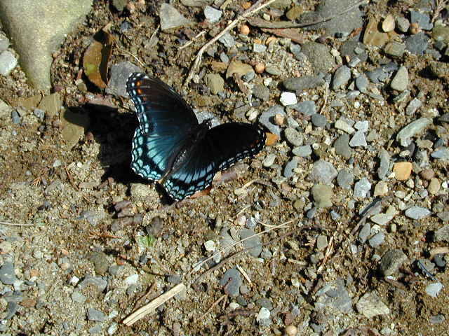
Smokies
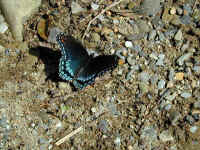
This is a picture of Cades Cove (basically,
a large mountain meadow) in the Great Smoky Mountains National Park. We
saw lots of wildlife here, but no bears. Here is one of the many, many
beautiful butterflies that you see all over the East.
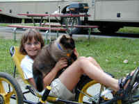
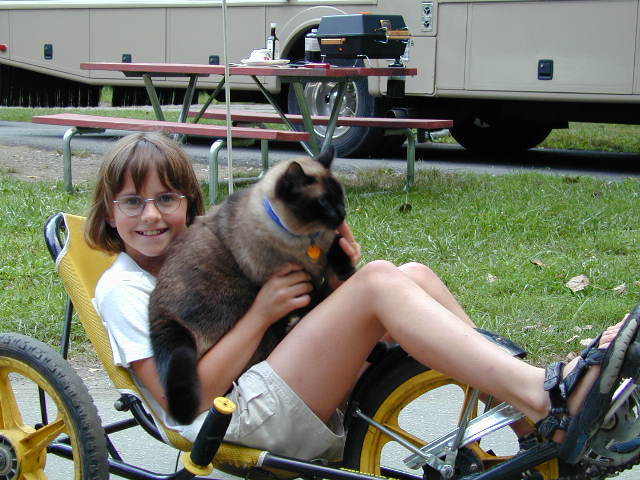
On the east side of the Smokies is the
Cherokee Indian Reservation. The first two pictures are views of the
reservation adjoining the Great Smoky Mountains N. P. Steffi takes Java
(not willingly) for a ride on one of the three wheeled bikes you can rent at the
Cherokee Campground. Fun! One interesting point: The U. S.
government made all the Cherokee Indians pack up and be forcibly moved to
Oklahoma in the late1800s. Thousands died on the march now known as the
"Trail of Tears". A number of
Cherokee Indians stayed behind, hid in the Smokies, and are now on this
beautiful Reservation, managing their proximity to a mountain resort very
successfully. In general, the treatment of Native Americans by the U.S.
has been appalling.
Back to Top
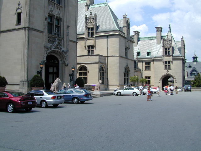
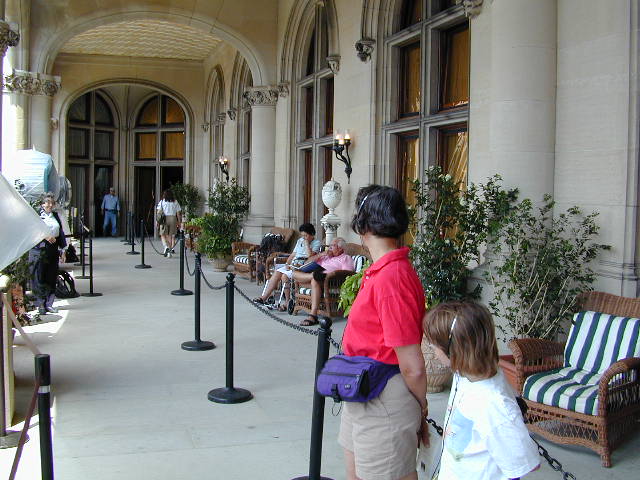
Biltmore Estate
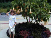


The Biltmore Mansion and Estate in
Asheville, NC is worth a visit. The main 'house', the largest private home
in the US, is three times bigger
than the White House! Stephanie enjoys standing under a neat tree with
trumpet-like flowers. Here are the Riches posing in front of the large
Mansion. The next picture from the front of the house looks like a scene from Europe. Jennifer and Steffi listen
to the taped tour and look at a balcony where cameras are being set up for a
movie which began filming the next day: the follow on to Anthony Hopkins', Silence of the Lambs,
called Hannibal. The gardens were gorgeous, and Steffi enjoyed one of the working statues...a turtle spewing water.
Back to Top
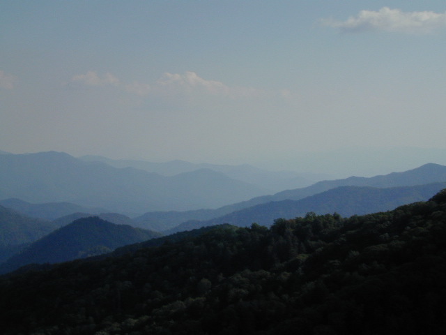
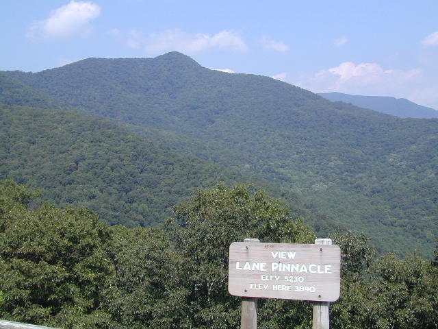
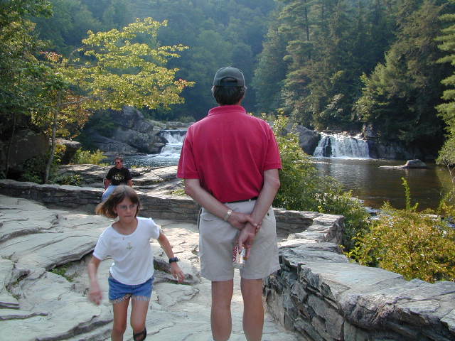
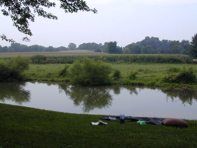
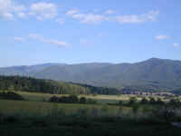
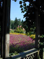
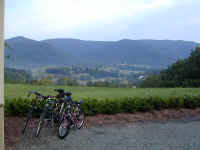
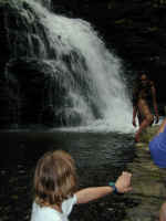
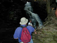
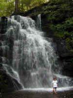
Blue Ridge Parkway

We spent the next 3 days traveling the Blue Ridge
Parkway, which begins in the Smokies and knits together local roads into a 469
mile long National Scenic Road. One of the many overlooks shows Lane Pinnacle Mountain, which we had to capture in honor of
Denny's business, Pinnacle West Corp. The sign says the mountain is 5,230
feet high. Next, Denny ponders a beautiful waterfall while
Stephanie races around on the rocks. Finally, there is a neat place called
Blowing Rock which Stephanie is standing beside with her hair blowing. The
Chickasaw Indian legend is that a lover jumped off this rock to commit suicide,
but the strong updraft created in the natural venturi blew him back up to the rock and into his Indian maiden's
arms.
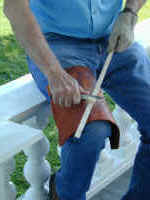
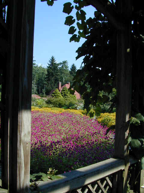
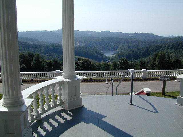
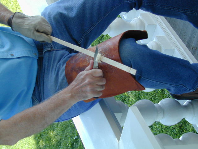
This is view off the porch of another
estate on the Parkway, albeit a much smaller one. The next picture shows a
man smoothing the oak strip he just split to weave into baskets. The baskets
he makes are extremely well done, but can cost more than $300 each. It's been
tempting, but we've not become collectors yet.
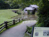
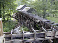
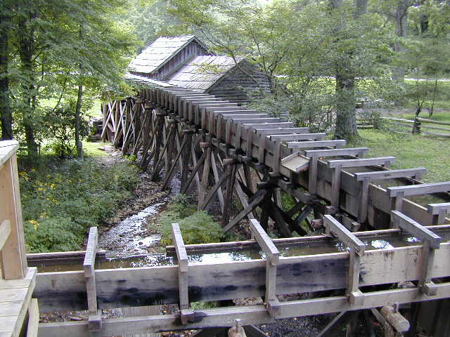
The Mabry Mill along the Parkway was driven
by the water aqueduct system shown on the right, which fed two small streams
into the mill. The mill would not only use water power to grind corn into
meal, but was also used to saw lumber and provide power for a mechanized wood
working shop. Pretty cool for the turn of the 19th century.
Back to Top
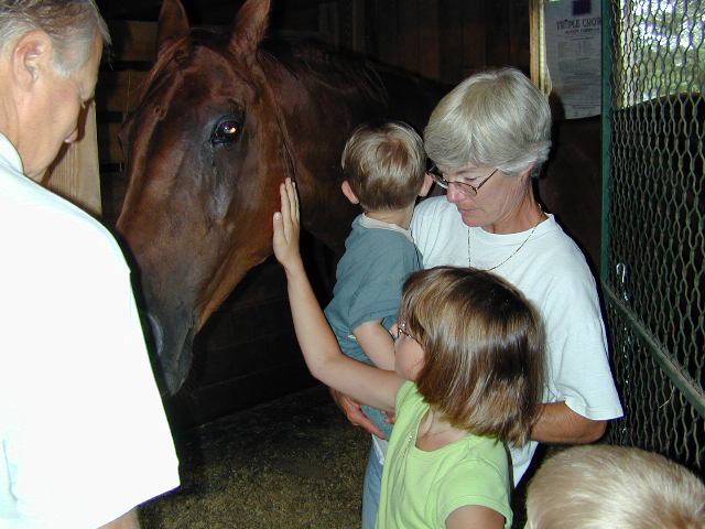
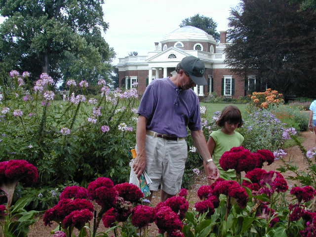
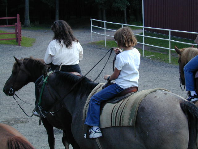
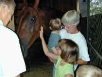
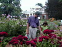
Charlottesville


After finishing the Blue Ridge Parkway we
visited our friends, Julie and Charlie Stamm, who live in Free Union,
VA, outside Charlottesville. Steffi enjoys petting a horse at one of
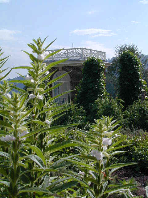
their neighbors. Thomas Jefferson's home, Monticello, is in Charlottesville
and here Denny and Stephanie examine some beautiful "pincushion" flowers in the front
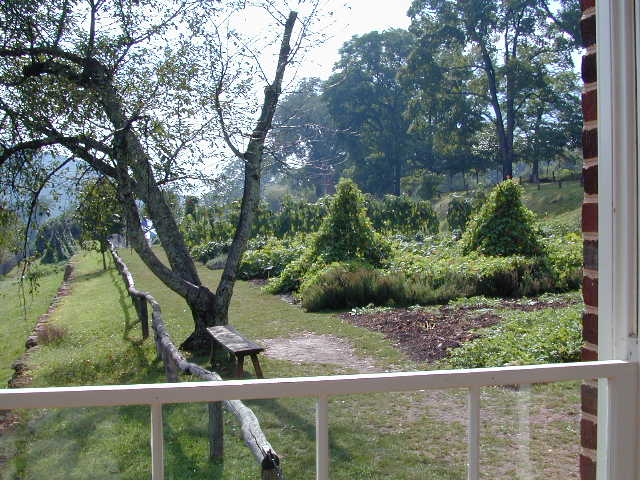
yard of the home. The next pictures show TJ's little shelter house and the view
of the vegetable garden he would have enjoyed sitting there. The garden has
been reconstructed as they think it would have looked
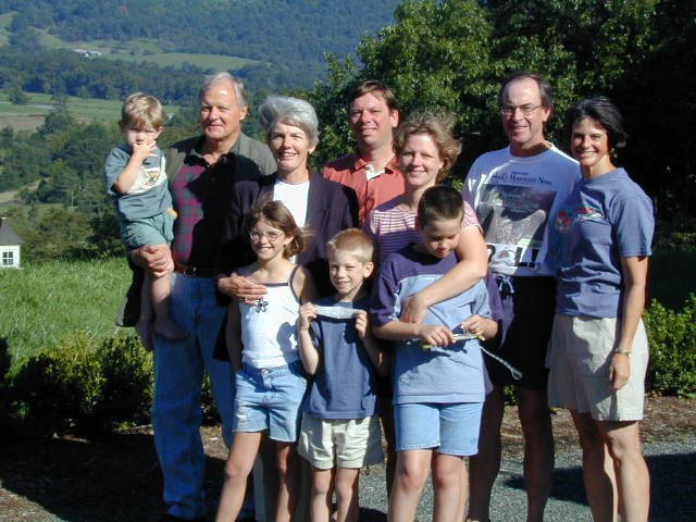
in the 1820s, including some ornamental beans whose flowers looked like orchids. A picture from the Stamm's house overlooking Skyline Drive
in Shenandoah National Park. Here is the Stamm's house party, including
the Swartz family, Charlie's daughter, her husband and children, who were also
visiting. A good
time was had by all. Steffi always enjoys other kids to play with; she and
Roger were buddies.
Back to Top
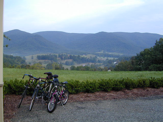
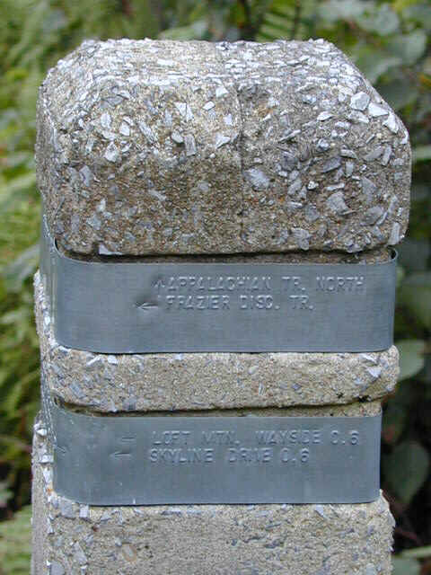
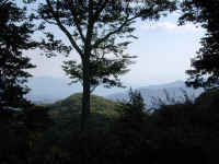
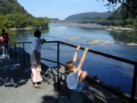
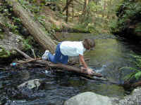
Shenandoah
This view looks east toward Free
Union, VA and the Stamms' neighborhood from Loft Mountain on Skyline Drive in Shenandoah National
Park. We hiked here and briefly joined up with the Appalachian Trail (the Appalachian Trial,
the AT, goes all the way from Georgia to
Maine!) This AT trail marker shows the trail where we hiked.
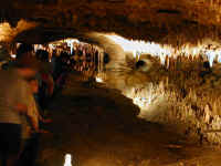
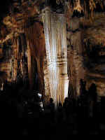
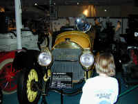
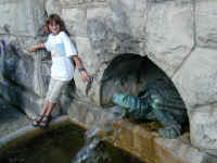
We left the Shenandoah National Park and
traveled west a few miles to visit Luray Caverns in Luray, VA. Admittedly,
this was a 'tourist trap,' but a VERY nice one. The above photographs (our
digital camera does a terrible job in dark places) show a bit of these very
large limestone caves. Click on the first picture to see what appears to
be a large cavern. Actually, it is a very clear lake reflecting the
ceiling and stalactites above. It is one of the coolest things
we have seen and very magical. The column gives a sense of how big the caves
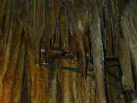
are. And, in the 1950s, someone figured out how to make an organ out of
the stalactites in one room of the cave. They hooked solenoids with a
striker to various columns to produce up to 37 different notes using what looks
like a regular large organ keyboard. These small sounds are picked up by a
microphone, combined and amplified back into the room using speakers. Very
delicate chime-like sounds and very cool. Finally, they had a very nice collection of very old cars.
Here, Stephanie studies a 1914 Locomobile which shows a a windshield for the
driver which looks like a monocle!
Back to Top
Harper's Ferry/Gettysburg

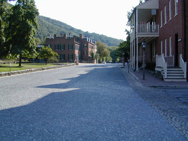
We moved on to Harper's Ferry, WV.
This town has lots of historical significance as John Brown's insurrection there
fanned the flame of controversy which resulted in the Civil War. At the
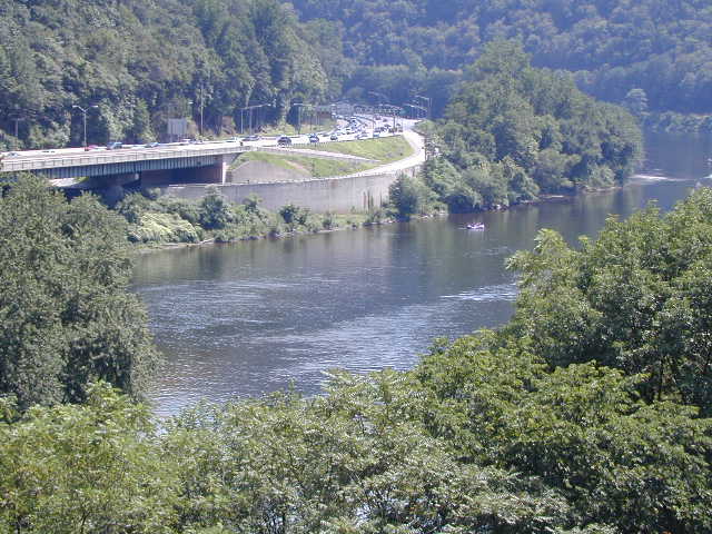
time, it was a very key place because of it's location at the confluence of two
rivers, shown in the first picture, with the Shenandoah River on the right
flowing into the Potomac River on the left and then on to Washington, DC,
roughly 50 miles to the east. The name comes from a Mr. Harper, who owned
a ferry business on both rivers before bridges and the railroads
were built. The town itself, shown next, has been preserved as a National
Historical Park and looks somewhat like it did in the mid 19th century.
This was the location of a US Armory, where rifles were made and stored. John Brown, who hated slavery, came here with a band of men and
took over the Union arsenal, planning to use all the rifles to start an uprising of the slaves. He was
caught and hanged, but his actions in 1859 polarized the views of people in the
South and the North and started the actions which eventually led to war.
There were several battles around here during the Civil War.
Floods hit here frequently and the town was heavily damaged last in about
1936.
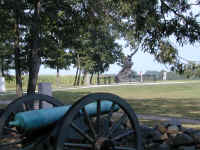

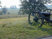
A trip to the Gettysburg National
Military Park in Southern Pennsylvania gave us a real perspective on the turning
point of the Civil War. Without taking you through all the history, this
park is really a fabulous place to memorialize all the soldiers who died here--
over 50,000!! There are memorials from all the states who had soldiers
here, both South and North and you can take numerous tours of the battlefield to
understand the actions on the the three days of the battle July 1, 2 and 3rd,
1863. The narrow victory by the North here marked the
beginning of the eventual defeat of the South.
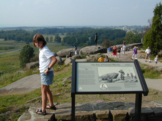
The first picture shows the North Carolina
Memorial, one of the more artistic ones. Stephanie stands on Little Round
Top, a small hill which turned out to be key in the battle. Union General
Warren, whose statue is shown behind Stephanie, discovered that
the hill was not being defended as had been ordered by General Meade. He quickly gathered some
troops and brought them here and defended wave after wave of Southern Soldiers
trying to claim the hill. Had they not done so, the South could have placed
cannon on the top of the hill and forced the North to vacate their
positions down the valley. If they had done that, the South might have won
the battle. Finally, a cannon is shown aimed at the valley where
Southern General Lee made a last ditch effort to win. The battle, known as
Pickett's Charge (named for the Confederate General who led the troops), had 12,000
men crossing all the way across the fields from the cannon to the trees on the
ridge in the distance.
The fighting was fierce, with 6,000 of the 12,000 Southern Soldiers dying in the
process.
Back to Top
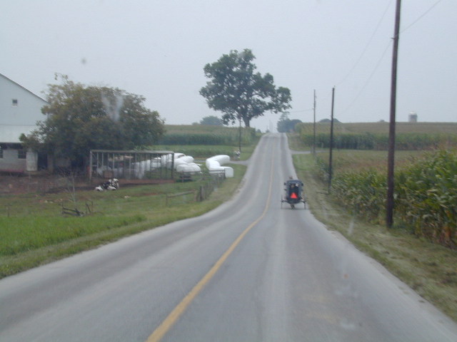
Amish Country
After Denny left for Denver, Jennifer and
Stephanie took off for Pennsylvania, spending a couple days in Lancaster. This
county is known for its high concentration of Amish and Mennonite people who
live a simple life using farming and crafts methods of the 19th century. The
first picture is of the demonstration Amish Farm where several of the children
are selling handmade bookmarks and oven fresh cookies. This tour gave us a solid
grounding in the culture and customs, and led us to appreciate the community
which mixes old and new so well. The buggy shown is typical transportation for
the Amish, and is generally pulled by a beautiful thoroughbred (usually a
retired racehorse) along the wide shoulder of the road. Occasionally the modern
and old style modes of transportation don't mix, however, as shown by the
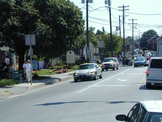
overturned buggy in the middle of downtown Intercourse, PA. We had seen the
horse racing wildly down the highway with an "English" car in cautious
pursuit a few seconds before encountering the wreck. The town alarm was sounded
and people were running to help from every quarter. At right is a scene from our
afternoon break reading by the Mill Stream. This is a gentle and charming place.
Back to Top
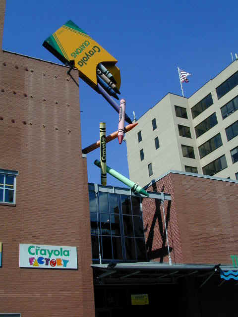
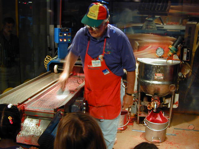
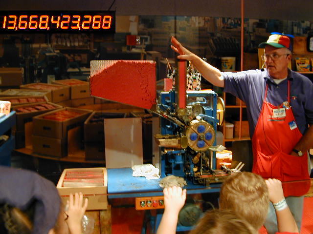
Crayola Factory
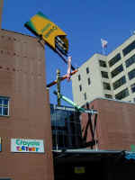


We headed next to Easton, PA and the
Crayola Factory where we learned all about how crayons and markers are made. The
sign at the right cut off the left-most digit, and represents the 113 BILLION
crayolas made. At a little over 2 million a day, it goes up pretty fast!
Back to Top
Poconos

We headed on to Scotrun in the Pocono
Mountains for a little R&R and found Steph a horse to ride in the mountains.
Steffi's Smoke was more cooperative than Jennifer's Moose!

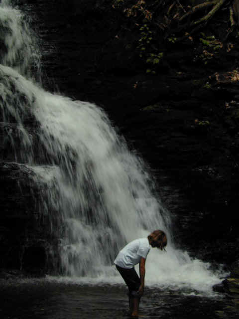
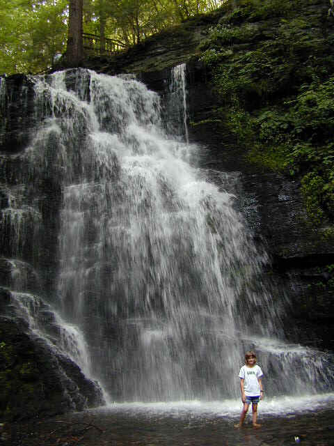
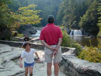
We also visited Delaware Water Gap National
Recreation Area and hiked in to see several of the Bushkill Falls. Though the
water is low, Bridesmaid's Falls was lovely and provided a humorous encounter
with humanity. As we were watching the lovely girl in her bikini be photographed
by a very fat photographer, two tiny kids wandered into the photo shoot,
oblivious to the gaping tourists. The dad took his cue to wade in to move the
kids to the side, and the uncle (in the blue shirt) couldn't keep his eyes off
the model. What a sideshow! The bottom shows the larger Bridal Veil Falls which
was quite lovely. The last picture is titled "Because It's
There."
Back to Top
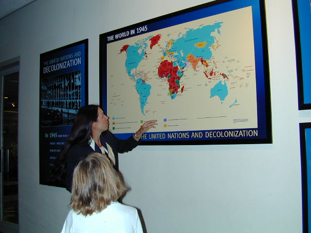
United Nations
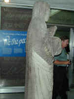


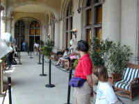
On Sunday we headed to Newburgh, NY to give
us access to NYC for one more attempt at a United Nations tour on Monday
morning. Thankfully Jennifer checked the web Sunday night to find that it was
AGAIN closing to visitors for two weeks for a worldwide religious conference and
then the opening of the fall session...starting at 1PM Monday! We hustled in on
the train and made it for one of the last tours before closing. The first
picture above is of the statue of St. Agnes of Hiroshima showing the melted
stone resulting from the atomic blast. The front was protected when the statue
was knocked down on its face. The Security Council Chamber looks like a stage
set and is quite striking. Our guide, Lina, from Croatia, is pointing out the
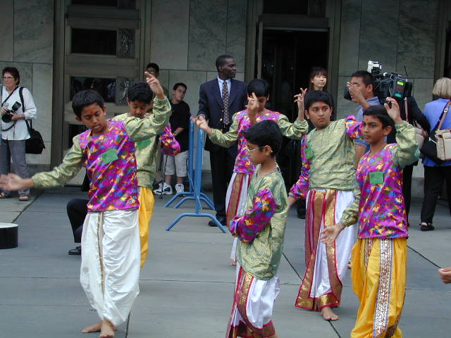
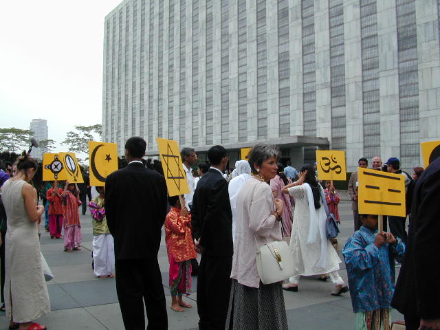
changes in colonial territories since 1945. We were delayed in leaving the UN
and found ourselves in the midst of the religious conference with literally
hundreds of colorful and rarely seen costumes worn by the various clerics from
around the world. These children are dancing and singing greetings for the
attendees as they entered the UN Plaza. Across the street was an equally
colorful group protesting the Dalai Lama's exclusion from the conference.
Security was very tight.

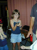
Stephanie is showing you her birthstone
ruby earrings. Quite sparkly, don't you think?
Our plan for Boston had
several interruptions, and we missed having a proper tour, but we moved on in an
attempt to beat the snow in the Rockies. We'll just have to come back.
Back to Top
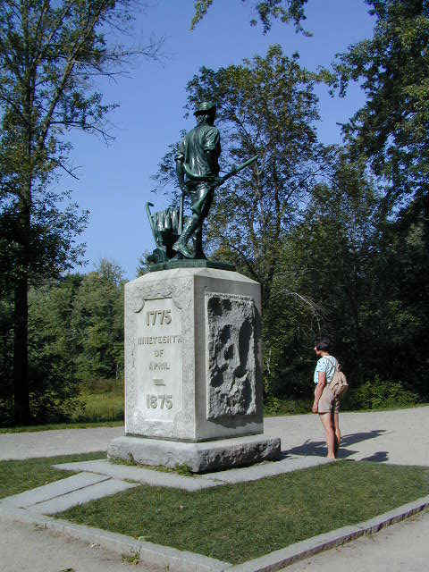
Minuteman/Lowell Parks

After picking Denny up in Boston, we had a
little time left for more history, this time at the Lexington and Concord
National Historical Park. The Minuteman statue shows him with his plow,
symbolizing how the farmers all came from the fields as soon as they heard the
British were on the march. The battles of April 19, 1775 were the beginning of
the Revolutionary War and are known as "The Shot Heard Round the
World." Another piece of trivia: Paul Revere never finished his ride and
was arrested en route. Dr. Prescott was the only one of the three riders who
actually made it to Concord to warn the village that the British were
coming!
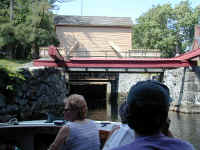
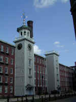


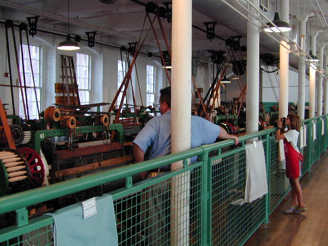
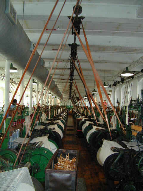
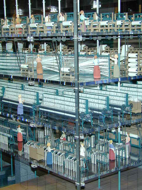
We next visited Lowell National Historical
Site where the Park Service manages a system of canals which provided
transportation and hydraulic power to run one of the most successful examples of
the Industrial Revolution. Unfortunately, as labor became short and
technology changed, the textile mills closed and 30 years ago it was virtually
derelict. Now, thanks to cooperation among the many community interests, Lowell
is coming back. The canal is open for ranger-led tours and provides power for
several co-generation plants run by new industries. At left we're shown
approaching a lock and flood control barrier. As with several of the mills, the
towers of the Boote Mill are refurbished now and house a variety of private
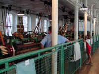
organizations. The museum inside has 90 of the period textile looms running
using the canal's water power and once again produces cloth. Only 13 of the
looms were actually weaving, but even then the noise was so loud earplugs are
encouraged. The model on the right shows the full "integrated
manufacturing" process Lowell introduced from blocking, carding and
spinning, through looming finished cloth. The "mill girls" who worked
here lived next door in the dorms.
Back to Top
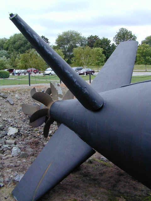
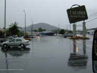
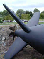
Portsmouth
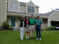
Continuing on to visit our friends Martha
and Ron Brestel in Hampton, NH, we returned to the ocean for the first time
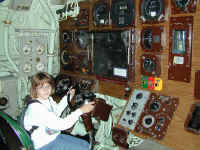
since Florida. Stephanie is shown at the diving controls for the research
submarine Albacore which was opened as a museum when it was decommissioned. The
tail shows the twin screws and the moveable control surfaces. Ron and Denny
think it should be machined a little more so it would have fit and finish like
an airplane!
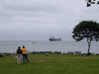
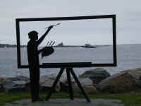
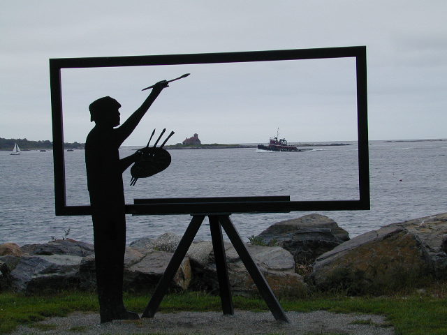
Portsmouth, NH is a shipbuilding city with
a large harbor. Jennifer and Martha are watching a huge fuel oil freighter leave
the harbor. The sculpture on the right captures the harbor light and tugboat as
it returns to port.
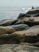
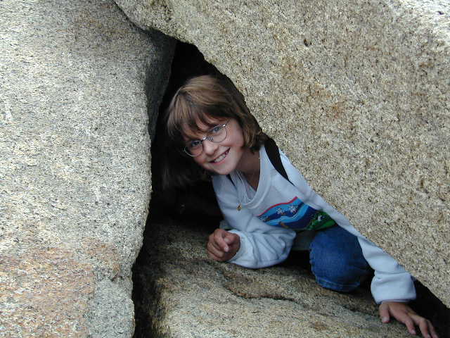
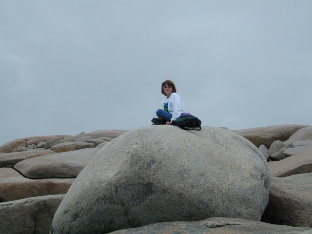
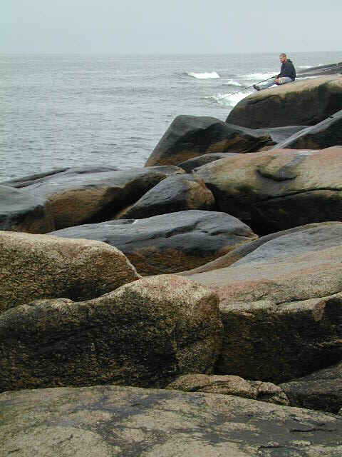
While Denny and Ron went flying over George
Bush's Kennebunkport house in Ron's plane, Martha, Steffi and Jennifer spent
some time on Cape Ann, the rocky peninsula north of Boston, and one of
Jennifer's favorite places in the world. Stephanie enjoyed the granite quarry
and rock hopping over the huge rock beach at Halibut Point State Park as did the
surf fisherman on the right. We were also privileged to see the newly placed
Gloucester Fishermen's Memorial listing all of the more than 5300 men who have
died at sea. While 1991's "A Perfect Storm" is a tragic tale, as many
as 15 schooners went down in some storms in the 1890s, killing hundreds. For a
small fishing town, the effect must have been devastating.
Back to Top
The next few weeks of our travels will take
us through Maine and southern Canada from the Maritime Provinces to the Rockies.
We hope you'll check us again in October. Until then, your email is always a
treat.