New
Zealand #1
North and South Islands
Travels through
New Zealand from Auckland to Dunedin: December
16 to January 18
(Pictures are
thumbnails. Click on them for a larger view. You may click on the subjects
listed to go directly to them.)
Subjects:
Auckland
Sheep Farming
Maori Treaty Grounds
Tane Mahuta Tree
AgroDome
Rotorua
Bay of Plenty Beach
Lake Taupo
Tongariro National Park
Wellington
Marlborough Wine District
Kaikoura East Coast
Pelorus River
Nelson
Buller Gorge
West Coast
Westland National Park Glaciers
Southwest Coast
Alexandra
Queenstown
Shotover River Jet Boat
Dart River
Fiordland
Milford Sound
Doubtful Sound
Routeburn Track
Gore-Clinton
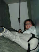
North Island - Rotorua Geyser
|
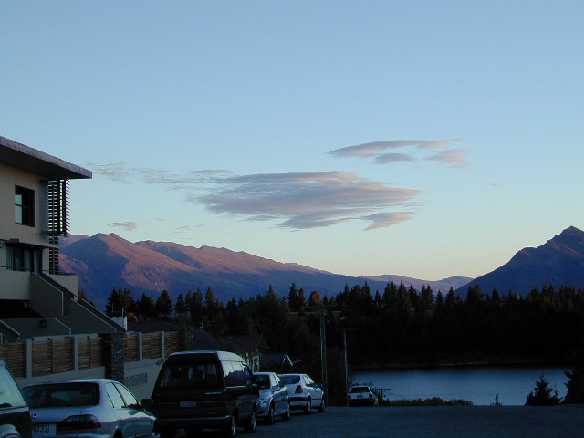
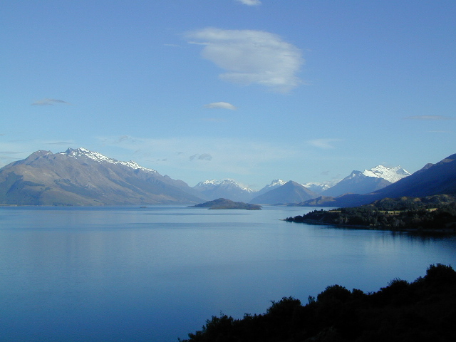
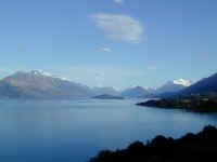
New Zealand is a beautiful green and mountainous country with
very friendly people and lots to see and do. We found the North Island and the South Island to
be very different places. It was almost like leaving one country and
entering another when we crossed between the two islands on the ferry from
Wellington to Picton.
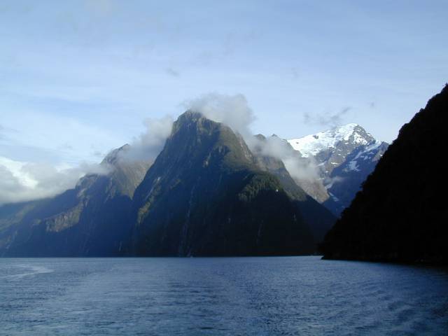
|
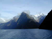
South Island - Milford Sound
|
We are still in New Zealand, having arrived in Auckland December 16. We left the Galapagos Islands on December 14 and
forever lost the day of December 15 due to crossing the International Date Line. (See the
route flight map archived from the last update.) We are now one day ahead
of Colorado, but only four hours behind on the clock. Kids, for a
geography assignment, get out your Atlas and figure that one out!!
This update will review our travels from our arrival in
Auckland, through the North Island and the South Island prior to our
current stop in Dunedin, where we are having lots of fun at a Reynolds-Macandrews
family reunion (for
Jennifer's Kiwi mother's NZ family). Our reunion photos will be included
with the next update, so stay tuned! We will still be in New
Zealand until February 1 when we depart for three weeks in Australia and then
what is known here as the "Near East". You can review our updated
itinerary by visiting our Itinerary
page. Be sure to check out the New
Maps showing details of New Zealand, and visit the new page showing some Interesting
New Zealand Facts.
Our trip from the Galapagos Islands to the
New Zealand Islands was very long--44 hours en route--but it was worth it as we arrived in New
Zealand!! This is the last super long trip of our Odyssey and hopefully
our lives!
Back
to Top
Auckland
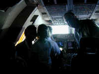
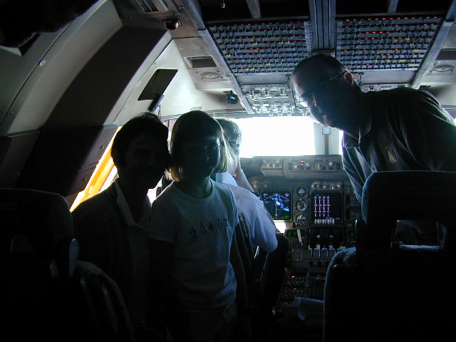
One of the advantages of flying over the big ocean is that
they let you visit the pilots on the flight deck. We think you may have to have a young kid to get let in, but we all enjoyed visiting the 747-400
and seeing the totally "glass cockpit" displays which you see behind
the Riches. The captain was 'busy' watching the autopilot fly along the
course to Sydney. It's a stressful job flying the oceans because you spend 14
boring hours flying there and then have to be alert to make the final
approach. No, they did not let Denny fly the jet to relieve
them!
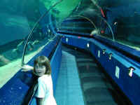
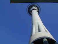
After arriving in Auckland and getting settled at our very
hospitable B&B, we went to see some sights in New Zealand's biggest
city. Here you see Stephanie in their enclosed 'in-the-tank' aquarium,
Kelly Tarlton's Antarctic Adventure and Underwater World. This 120 yard long tunnel, complete with
moving walkway, was probably the first in the world, having been completed in
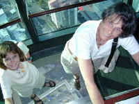
1983. Steph is pointing to one of the huge rays in the enclosure. Next, you see Jennifer hanging on for dear life while she stands on
a glass panel at the very top of the 1,082 foot sky tower. They say the
glass is stronger than steel, but Stephanie still is laughing at Mom's
acrophobia. There is a revolving restaurant up there, but we didn't have
reservations.
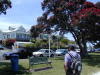
On our ferry trip across the bay to the little town of
Devenport, Denny enjoys looking at the beautiful red and green pohutukawa tree,
which is known as the New Zealand Christmas tree, because it blooms bright red during the
Christmas season. A short walk from the seaside village is North Head,
which was a defensive position that both the Maoris and later the Europeans used. The huge guns
were placed there in the 1880s for defense against Russian intruders into the Harbor, who
apparently thought NZ was an attractive colony themselves. The guns have never been used
and a couple of them are still there as you can see.
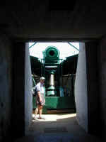
The entire hill is honeycombed with tunnels used to store ammunition and to support
the guns without being exposed outside. You can explore most of the tunnels
which are mainly in the dark. Stephanie loved it! If this were in the
US, there would be lights and safety warnings. Kiwis just have fun.
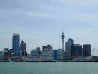

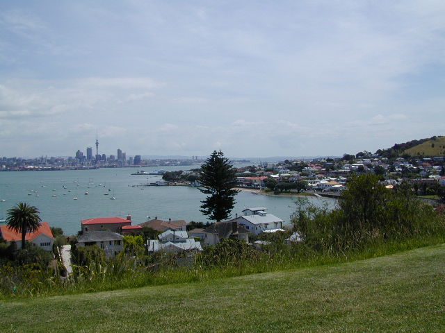
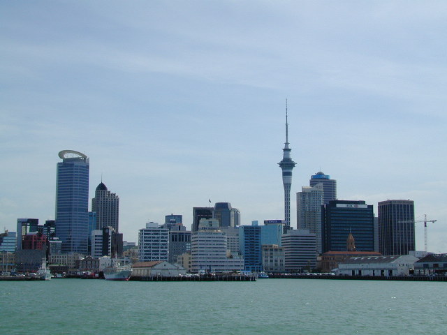
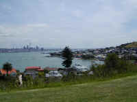
On the way back in the ferry, we took a picture of the modern
downtown. This is in stark contrast to most of New Zealand which is
largely rural or mountainous. We are enjoying visiting many friends and
relatives in New Zealand that we have never met, including Justine Clarkson who lives in Auckland.
Back to Top
Sheep
Farming
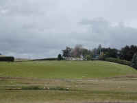
After a couple days in Auckland getting over our jet lag, we
set off for the Northland. (See the maps in the New
Maps update.) Along the way, we
noticed most hills contained some small white bumps in the grass, which we
dubbed "grass lice." If your click on the picture for a better
view, you can clearly see that this is a typical hill of sheep grazing in front
of the farmer's nice home. There are about 70 million of them in New
Zealand (compared with 4 million people), and they are everywhere. We don't show similar pictures of other
hills and fields which have large herds of cattle, deer, llama, and
occasionally emus and ostriches. Farming and ranching is BIG business in
New Zealand.
Back to Top
Maori
Treaty Grounds
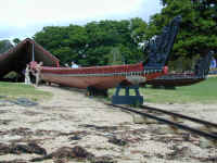
At the north end near the Bay of Islands,
we stayed near where the Treaty of Waitangi was signed in February 6,
1840 between the British and many of the Maori chiefs, acknowledging the British
Crown. The British recognized the Maori as the legitimate landowners and
made them British subjects. Controversy, to this day, still arises over
Maori rights to land, which the Brits had subsequently sold or distributed
amongst themselves. This picture, on the grounds of the
original treaty house, shows a ceremonial Maori war canoe (or waka) which is
used each year to commemorate the treaty. February 6 has the same meaning
in New Zealand as July 4 has to us in the US. The weather, unfortunately, was
not too good while we were at the north end, and we had to cancel our sailing
touring plans! Bummer.
Back to Top
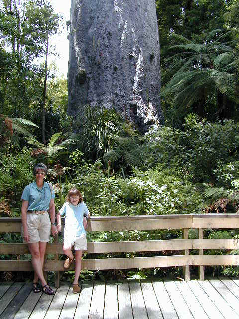
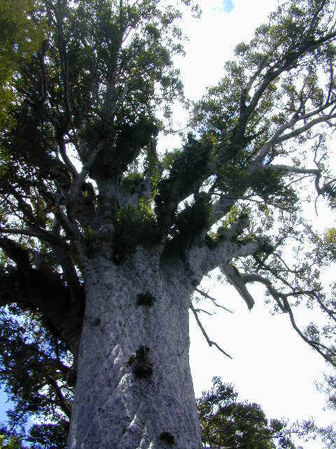
Tane
Mahuta Tree
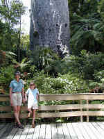
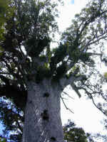
On a warmer day, we proceeded from the Bay of Islands to the
West Coast of the North Island and went through the Northland forest parks. These parks have many
of the endemic trees and a notable one is the kauri,
which has been logged considerably because of its huge straight trunks. These areas are now controlled and
farmed appropriately. At one place there is a tree called the Giant Kauri,
Tane Mahuta, God of the Forest. This is the tree shown above with Jennifer
and Stephanie standing in front of it. It is very large, 51.5 meters (170 feet)
high, and is
estimated to be over 2,000 years old.
Similar in diameter to our giant redwoods, this tree is a Maori legend.
The legend maintains that long ago the land and the sky were one and everything
was dark. Then, this tree (son of the Sky Father and the Earth Mother)
grew between the sky and the land and pushed the sky up to its current place
thereby letting in the light and allowing all things to grow.
Back to Top
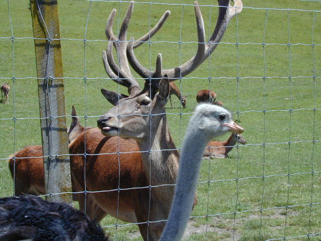
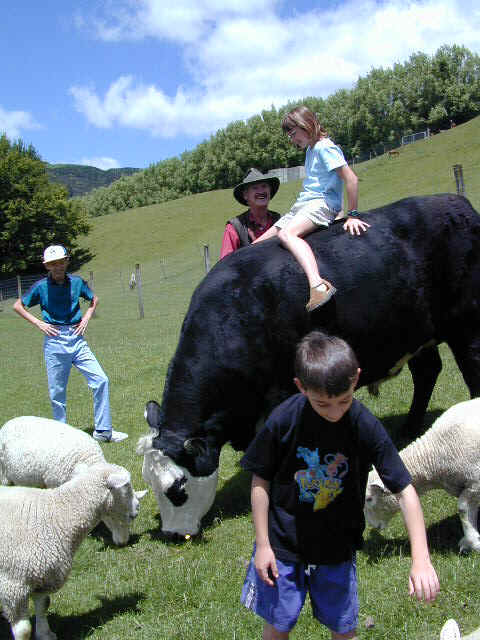
AgroDome
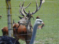
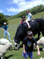
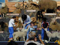
A couple of days later we were on our way to Rotorua, southeast of Auckland. We stopped at a place called
AgroDome (clearly a
tourist place, but very fun). We saw fields of animals, including the deer,
sheep, cattle and
ostriches you see here. Stephanie had a chance to sit on a bull
while the ever-present sheep were munching on grass close by. At the
AgroDome, the show demonstrated New Zealand sheep farming, complete with
working sheepdogs. In the next
picture, you see Stephanie on stage feeding a lamb while 19 different varieties
of sheep are calmly on stage behind her.
Back to Top
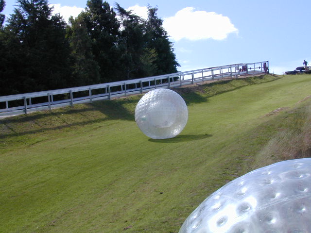
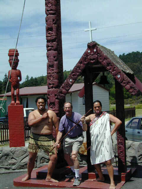
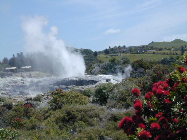
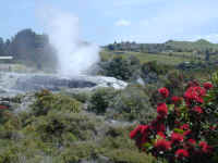
Rotorua
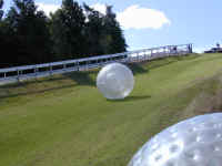
New Zealanders are very resourceful and invent all sorts of
things -- including outdoor sports. This big plastic ball is called a Zorb,
and Stephanie is inside it (one ball inside another bigger ball) slipping and
sliding on water while she rolls down the hill. New Zealanders also invented
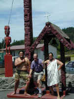
Bungee Jumping, but all of us are passing on that sport. Next, we visited
a Maori village in Rotorua where we learned a lot about Maori ways. Denny is
standing here with two Maori warriors showing off their meanest looks to scare
away any enemies. We also learned the Maori greeting Kia Ora, which
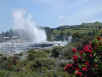
would be similar to Aloha in Hawaii. Rotorua is an active geo-thermal
area. In the last picture, you see a geyser that has been constantly going
off for over 280 days in a row. We also enjoyed the rainbow pools, splattering mud
paint pots, and boiling pools, just like Yellowstone. Thermal areas are
found primarily on
the North Island.
Back to Top
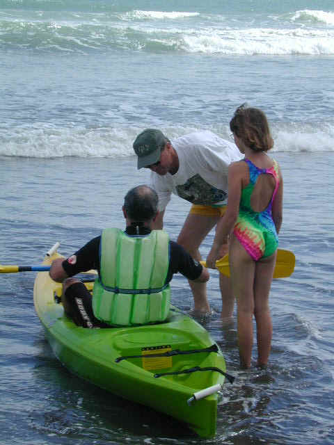
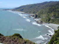
Bay of
Plenty Beach

We met cousins, Hugh and Heather Reynolds, and stayed
at their house in Rotorua while they went off to stay at their beach house on
the Bay of Plenty, 90 minutes northeast on the Pacific Coast. We joined up with them
on Christmas and spent the following few days enjoying them and the beach.
Hugh and Stephanie toured in their ocean kayak; above Hugh is getting help he did not
need from Denny and Stephanie.
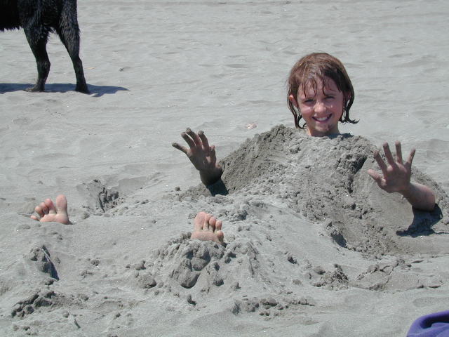
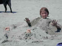
Stephanie loves the beach and decided to get buried in the sand. While
this was fun, we did learn for the first time that New Zealand does have one
major human predator -- the terrible Sand Fly!!! These little creatures will
bite you, without you knowing it, leaving a welt which then starts itching for
several days. So, we NEVER EVER go outside, especially near water in
the morning or evening, without insect repellent. Luckily, the insect
repellent works well.
Back to Top
Lake Taupo
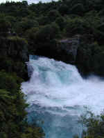
Leaving Rotorua, we went south towards Lake Taupo, which is a
lake formed in a very large volcano caldera. This volcanic area is still
active, and will one day, blow up again. In the meantime, people enjoy the
area, noted for the best trout fishing in the world and use the phrase,
"No worries." The first picture is of a gorgeous fall coming out
of the lake called Huka Falls. We also had the opportunity to stay one
night with friends Noel and Jenny Smith at their house on the beach at Lake
Taupo.
Back to Top
Tongariro
National Park
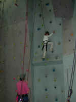
We were excited to proceed on our way to visit Tongariro
National Park, the site of very active volcanoes on the North Island (and where
Jennifer learned to ski in 1969). Mt.
Ruapehu, one of the three volcanoes in park last erupted in 1996 and
threatened skiers who were skiing its slopes at the Whakapapa Ski Field.
The other two volcano peaks are Mt. Tongariro and Mt. Ngauruhoe are just a few
kilometers away.
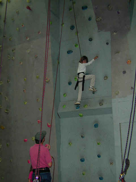
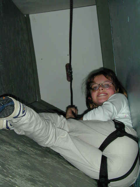
Unfortunately, the weather was very bad with low clouds and rain as you can see
on our return down the hill from the Whakapapa Ski Field. We were there
two days hoping for a break in the weather, but no luck, so we took
advantage of some Kiwi sports. There was a climbing wall located in a town
called, of all things, National Park. It had about 50 different
climbing walls inside and Stephanie tried most of them, successfully (which some
of the French climbers who were there with their fancy shoes cannot say). The last picture
shows her inside a 'chimney' climbing wall having a great time. If you want to see pictures of the
volcanoes, they are on the Internet. Use our favorite search engine, www.google.com
to find them.
Back to Top
Wellington

From Tongariro National Park, we headed for the west coast and the
Tasman Sea again. After passing Wanganui, we visited
friends, Douglas and Gwynneth Smith (Noel Smith's parents) shown at their beach house
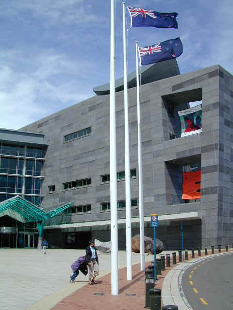
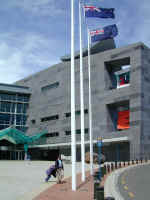
located in the town of Raumati/Paraparamu, just north of Wellington. We then proceeded south to Wellington,
capitol of New Zealand. While there we enjoyed the NZ National Museum, Te Papa. The building's design is unique and
controversial.
Whatever your feelings about the architecture, it is filled with
great exhibits about New Zealand and Maori culture. Two visits were not
enough to see it all.
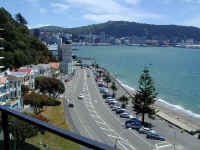

While in Wellington we stayed at the Smith's apartment overlooking
Wellington Harbor. You can see the gorgeous view we had looking back at the
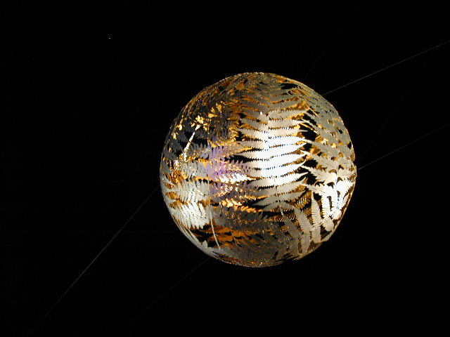
city. On New Year's Eve, we went to the downtown Wellington street
festival to celebrate. It is similar to Denver's "First Night" and is
great people watching while you listen to various bands. This beautiful ball,
depicting the New Zealand silver fern, was hung over the crowd at
their City Centre. Click on
it to get a clearer view as it is quite beautiful. We returned to the apartment
hoping we might see a great fireworks show over the harbor from the balcony. No such luck, as
there were no public fireworks celebrations. We would have traded the rock and roll
for some beautiful fireworks over
the water!
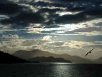
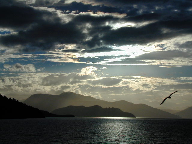
On January 2, we boarded the ferry for an evening ride from
Wellington to the small town of Picton on the South Island. Here is a great
shot of the sun starting to go down as we proceeded through the beautiful Tory
Channel on the South Island.
Back to Top
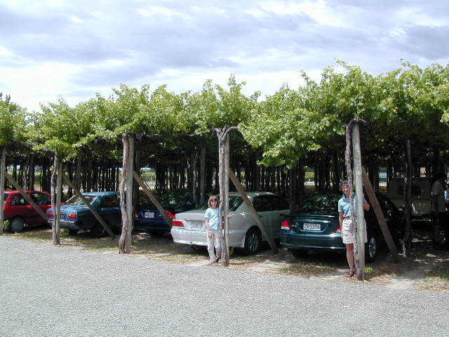
Marlborough
Wine District
We stayed in a good sized town called Blenheim in the heart of the Marlborough Wine District. They grow some very, very good
Sauvignon Blanc wines, among the best in the world. We spent a
day touring a number of wineries sampling and buying wine including very good Chardonnay,
Pinot Noir and Merlot wines. Cabernet Sauvignon is primarily grown on the North
Island where the temperatures are hotter and will allow that grape to
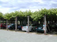
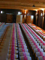
mature. Stephanie and Jennifer have just parked the car under some grape vines tall enough to shade our car. Next, you can see the beautiful
aging room at the largest NZ Winery, Montana. This wine is sold in the US under
the label Brancott to avoid the reference to our state, Montana, which is not
noted for its great wines. The French oak barrels you see contain Pinot
Noir wine. This building is obviously for tours. Other aging
rooms would not be so nice on the eyes.
Back to Top
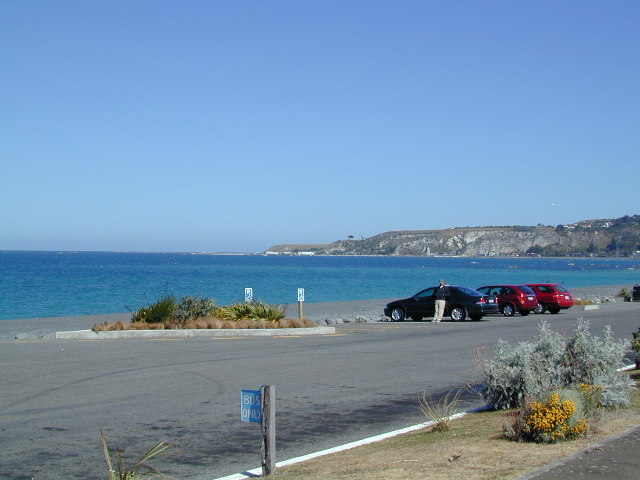
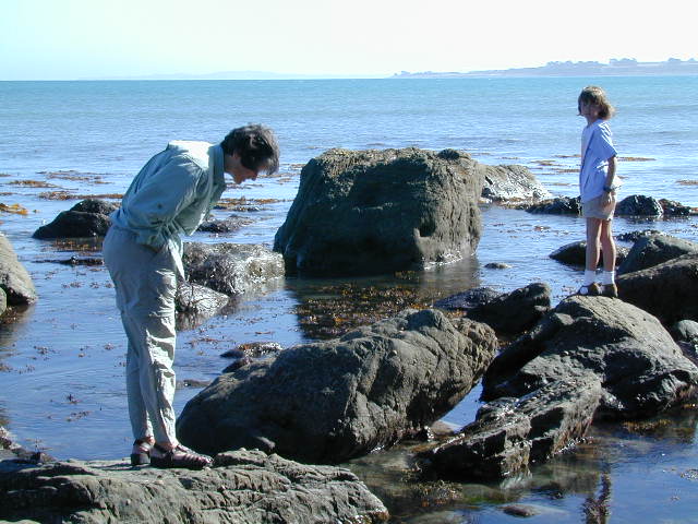
Kaikoura
East Coast
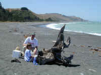
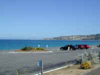
A town on the East Coast named Kaikoura is noted for its
outstanding whale
watching. Here you see Denny and Stephanie on the beach enjoying a picnic
lunch on the two hour drive to Kaikoura. Sadly, we found out that
the boat trips had been cancelled that afternoon due to high seas. Denny
is seen here leaning against the car in the deserted parking lot contemplating
what might have been. Oh well. We previously saw whales in the
Northern Hemisphere at the Bay of Fundy in Canada, and we did have a great
picnic, but Jennifer had her heart set on seeing one of the big resident
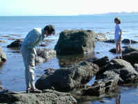
sperm whales. Someday. On the way back, Jennifer and Stephanie checked out tide pools
for various sea creatures and plants.
Back to Top
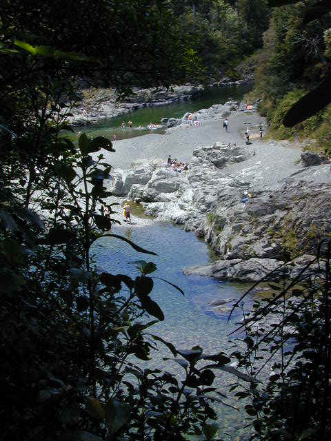
Pelorus
River

On the way to Nelson, known for its great beaches and sunny
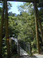
weather, we stopped at a park on the Pelorus River and took a hike across a
suspended bridge and on down to this great swimming hole. Stephanie and Denny had a great time swimming in the crystal
clear water. Jennifer basked in the sun with her book open.
Back to Top
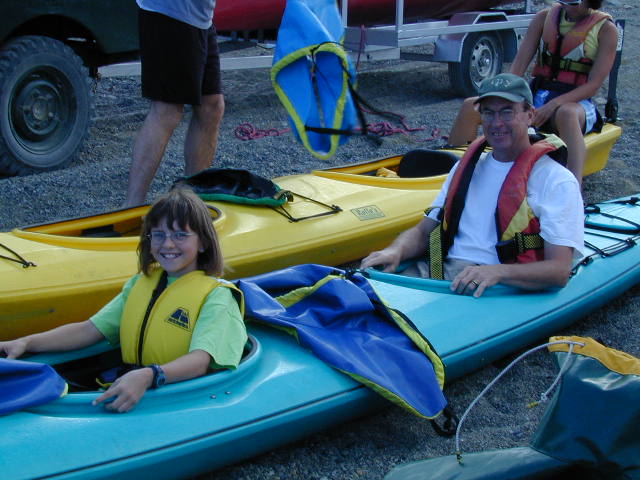
Nelson

We enjoyed Nelson a great deal with the exception of some
noisy late
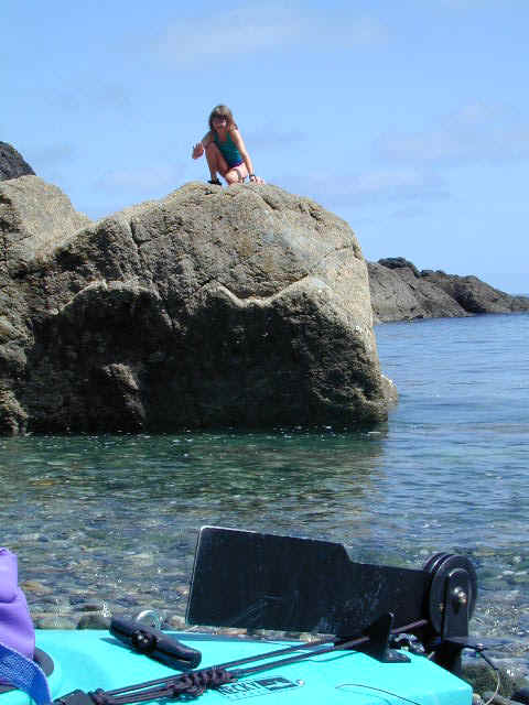
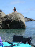
night holiday party-goers. One morning, we went sea kayaking. Stephanie
and Denny are getting checked out in the very stable sea kayaks. We
toured the sound and had fun going in some narrow caves. At one spot we
stopped for a snack and Stephanie took that opportunity to climb a large rock in
the water. This was tough...as you see there are no easy faces to grab
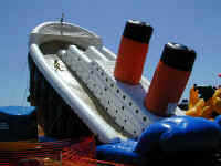
onto from the waist-deep water. Finally, to make the point that Nelson is really a tourist
destination, this inflatable slide, in the form of the ship Titanic, was set up
in the park across from our motel. You can see Stephanie reliving the movie by sliding down the
deck on the left side of the ship.
Back to Top
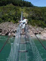
Buller
Gorge
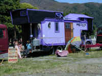
As we proceeded southwest from Nelson to the west coast, we passed a
fair in the middle of a group of very unique RVs where the owners were selling their
various wares. You can see a typical one here painted in a lovely shade of
purple. It was straight out of the 1960s, and took us back to the days of
bent wire jewelry and tie dyed headbands. Further along the way
we followed the Buller River Gorge. Stephanie and Jennifer
are enjoying swinging on the suspended bridge high above the river. The
return across the river was in typical Kiwi style, flying (and screaming) along in tandem
on the hanging wire you see in the next picture.
Back to Top
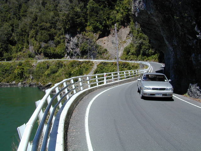
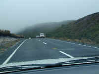
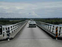
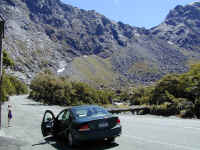
West Coast
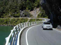
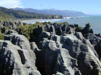
New Zealand's two lane roads are great, but they don't waste money on such things as two lane bridges. One-way bridges are the
norm and you have 'Give Way' signs at either end telling you who has right of
way on the bridge. Similarly, when the road has to be cut into a rock cliff,
passes like the one you see here permit one car at a time to pass under a cut in the rock wall. Noting
the drop off the edge we were glad for the sturdy guardrail! The
Tasman Sea and shoreline on the west coast is quite beautiful. Foliage grows right down to the water and is quite lush due to
the massive amounts of rain that they receive there. The West Coast
receives as much as 9 meters of rain in a year in some locations, while over the
Southern Alp Mountains to the east, the rain drops off quickly to about 1 meter
a year or 40 inches--still a lot more than Denver's 15 inches. The last
picture shows a geologic formation called Pancake Rocks in the Paparoa National
Park. If you click on the picture, you get a good view of the odd-looking
pancake stacks formed when the sea erodes limestone
and sandstone layers uplifted from the ocean bottom.
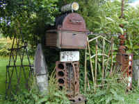
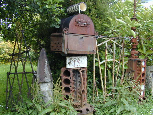
Passing through one town, we saw a 20-30 ft. fence showing some real
Kiwi ingenuity using what would otherwise be junk to make a work of art. Notice
the V-8 holding up the mailbox and the straight 6 engine block to the right!
Back to Top
Westland
National Park Glaciers
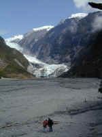
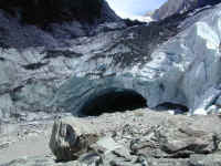
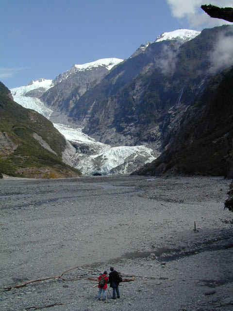
Westland National Park is the home of two very large glaciers,
the Franz Josef Glacier and the Fox Glacier. We were hoping to be able to
get a helicopter flight here to fly over the glaciers and also to go around Mt.
Cook, which is the highest point in NZ at 3,754 meters (12,349 feet).
Alas,
the clouds were too low to allow a flight over the mountains. NZ wisely
restricts flights to at least 3,000 feet above the ground, even though you can land on
the glaciers themselves. In any case, we took hikes to the termination
face of both glaciers. The first picture shows the alluvial river and boulder field below the
Franz Josef Glacier with the next picture showing the 'cave' where the melting
water flows from the bottom of the glacier. We wish that we had signed up
for a guided tour so we could have climbed on the actual glacier with ice axes
and crampons.
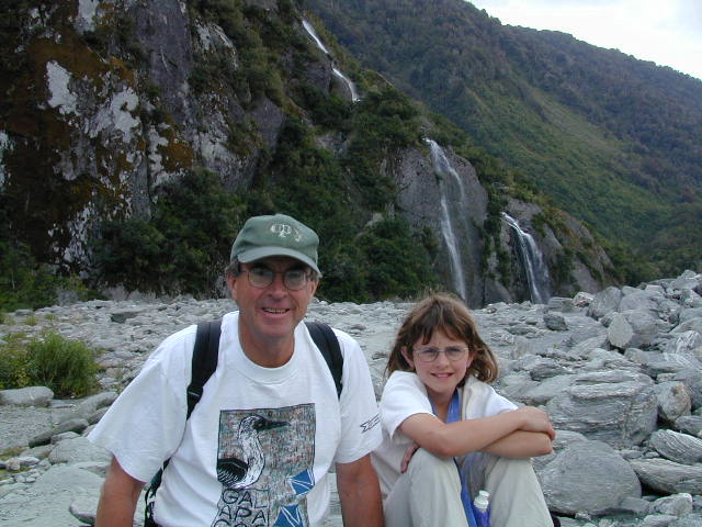
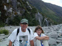
Stephanie and Denny take a break on the hike by resting on one of the many rocks
deposited by the Glacier in times past. The glaciers have retreated a long
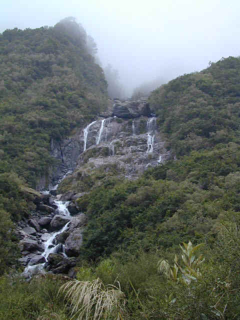
way from the termination location noted in 1750. At least the rain enhances
the ever-present waterfalls
in the background.

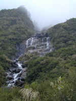
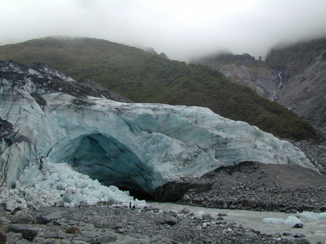
This picture shows the termination face and the cave at the
end of the Fox Glacier on an even drearier, cloudy day. Again, the
waterfalls come right down out of the clouds to the bottom of the glacier
valley.
Back to Top
Southwest
Coast
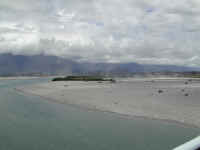
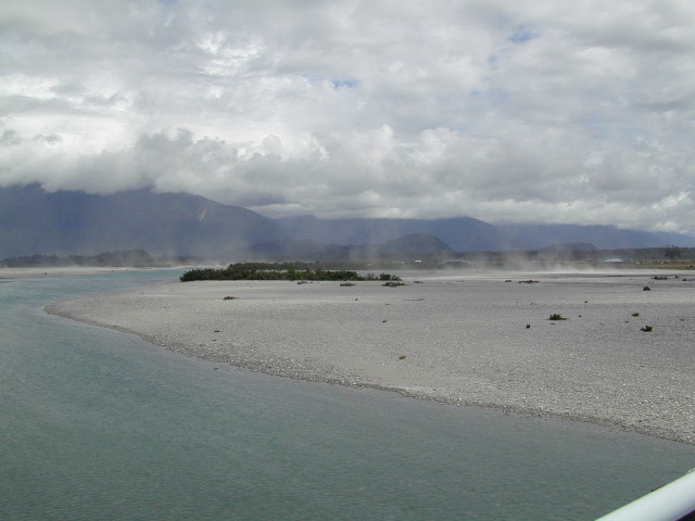
The first picture shows a river flowing down from the Southern
Alps carrying rocks and silt from glaciers higher up. The water takes on a
very gray appearance from the glacier rock sediment. You can see wind
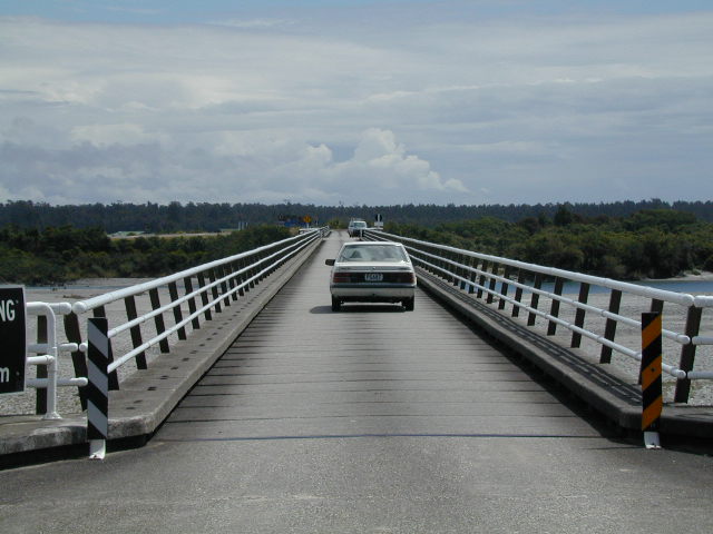
easily blowing the fine silt in the background. Next we're in the
middle of the longest
one lane bridge in NZ, 700 meters. It does have three wider turnouts to
allow two cars to pass. We often wondered how we would have fared driving
our RV, Betty, in New Zealand on roads like this. Lastly, Denny is looking
over the mouth of the Haast River, which was the furthest point South that
was practical to go to on the West Coast. From that point, we turned east
to head toward Wanaka and Queenstown over Haast Pass, another miracle of
road engineering that skirts the huge Mt. Aspiring National Park. You can see the beautiful Southern Alps in the
background.
Back to Top
Alexandra

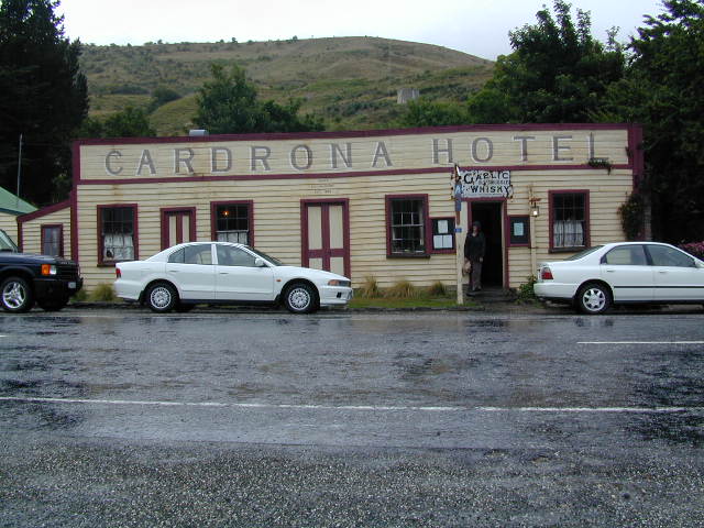
One road from Wanaka to Queenstown goes over the steep Crown
Range and, along the way, many people had told us to stop by the Cardrona Hotel and
Tavern shown here. The tavern is next to the Cardrona Ski Field. It
was a delightful place with great food and many people stop here to eat.
While eating our lunch, we found a book that described old taverns in New
Zealand, such as this one. The story of this tavern even had a reference
to Jennifer's uncle Dick Reynolds the bookseller, who was known to stop by for a drink or two.
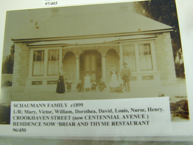
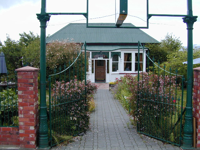
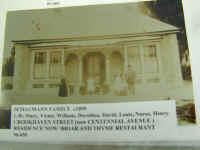
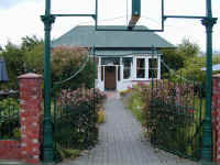
We also took a side trip to Alexandra where Jennifer's maternal grandmother
Dorothea Schaumann had grown up. In addition to finding lots of family lore in
the local historical museum, we found the family home is now the Briar and Thyme
Restaurant. The proprietor greeted Jennifer with a friendly "Welcome
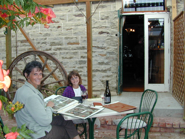
Home" and happily showed off his restoration efforts. We sipped wine and
admired old photos while we waited for the establishment to open for a memorable
dinner.
Back to Top
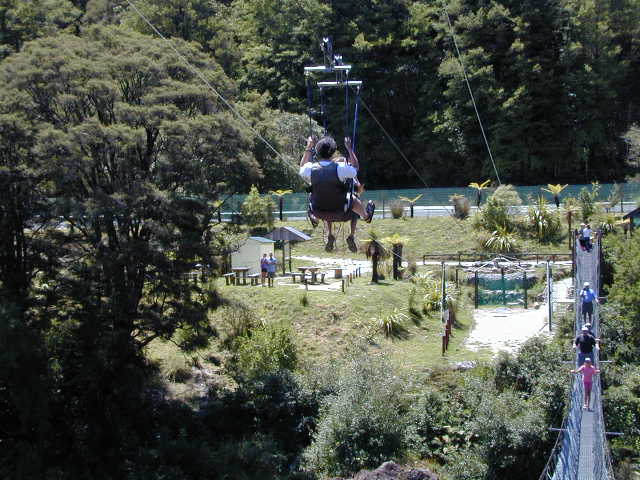
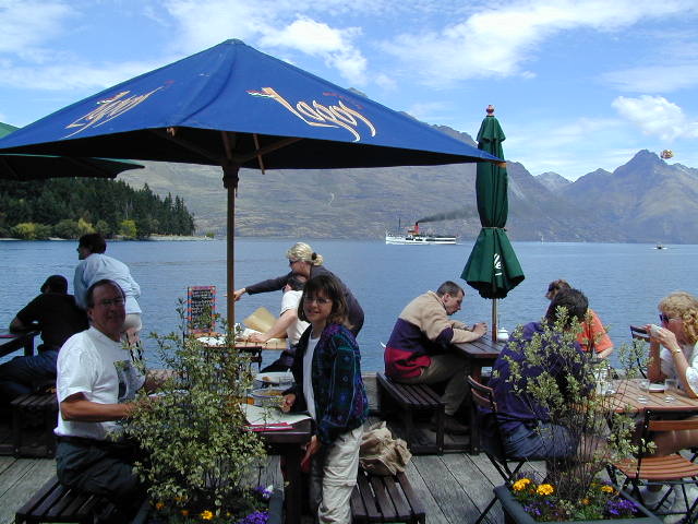
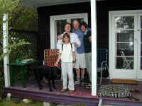
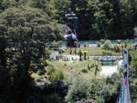
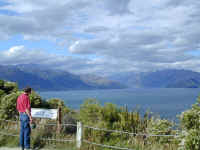
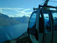
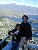
Queenstown
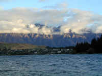
Queenstown is a lovely town and a major tourist center with
lots to see and do. It is located on Lake Wakatipu which you see
here. In the background are some very pretty mountains named
"The Remarkables." The next picture is taken in front of the
condo we stayed in while in Queenstown.
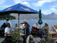
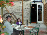
The Riches enjoy a lunch on the wharf in Queenstown.
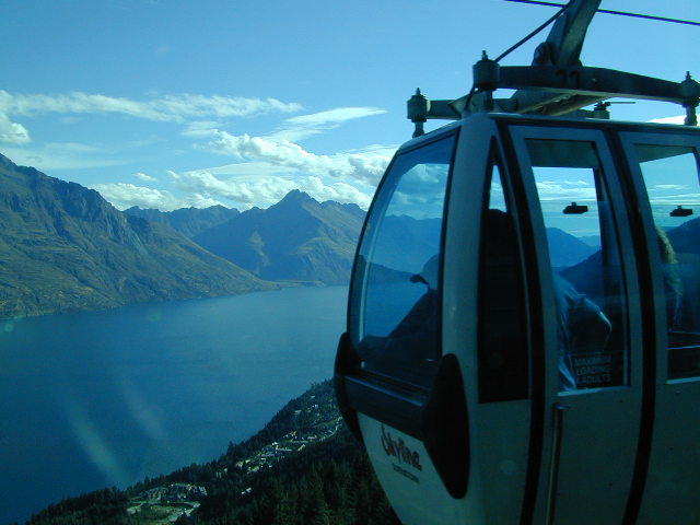
Notice the old 1906 steamer Earnslaw in the background. Above Queenstown is
a gondola that takes you up about 470 meters above the town. You can see
the view one gets of Lake Wakatipu from the top. Stephanie and Jennifer
stand on the viewing platform overlooking the city and the Remarkable
Mountains. The angle of ascent is about 37 degrees from bottom to top, so
it is quite steep. At the top, you can bungee jump or ride The Luge (a
sort of an alpine slide). We tried the luge and passed on the bungee
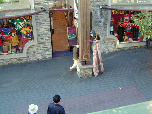
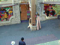
jumping. One evening as we were having dinner on a balcony overlooking the
village pedestrian mall, a mime on stilts was entertaining. It was a
lot of fun to watch him, and Stephanie particularly enjoyed seeing him include all the passing
tourists in the fun.
Back to Top
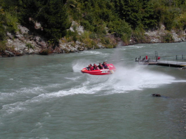
Shotover
River Jet Boat
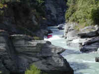
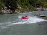
In 1954, a Kiwi named Bill Hamilton invented the jet boat,
which takes in water and uses an engine to propel the water out the back at a
high velocity rather than use a propeller. This allowed him to create a
very maneuverable craft that could go very fast in very shallow waters and
also allowed him to go where boats could not in the past. Outside Queenstown, we rode a
jet boat on the Shotover River which you see in these pictures. The driver races
through the narrow canyon at speeds up to 70 kph. The last picture shows a
jet boat executing the trademark high speed 360 degree turn and stop. Quite a thrill!
Back to Top
Dart River


We also took the opportunity to take a second jet boat ride,
this time on a long trip up the Dart River into the wilderness (Mt. Aspiring
National Park) near the eastern base of the Barrier Range of the Southern Alps, seen in the background. At one point, we entered a side stream shown in
the next picture. This allowed up to take one of our more scenic shots of
New Zealand with Mt. Pluto in the background. The next picture
gives you some idea of how shallow the water can be: the jet boat can skim
over water that is only 3 inches deep. After our exciting ride, the wind
came up, and you can see the effects of the wind blowing the glacial silt in the
river bed around.
Back to Top
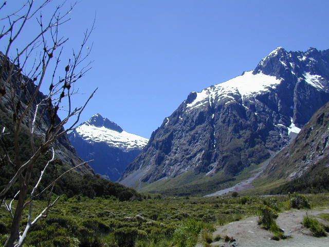
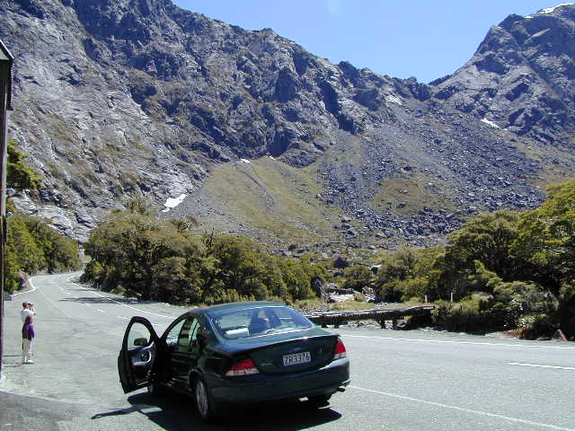
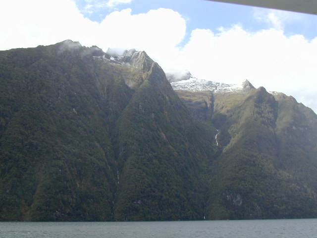
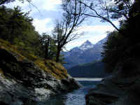
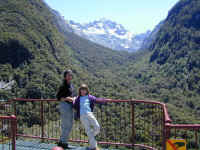
Fiordland


After moving to the town of Te Anau, we took several trips
into the Fiordland National Park which runs along the Southwest Coast of the
South Island and is bigger than all the other NZ national parks combined. We
took a boat across Lake Te Anau to see a great Glow Worm cave with a river
roaring through it and visited both Milford Sound and Doubtful Sound.
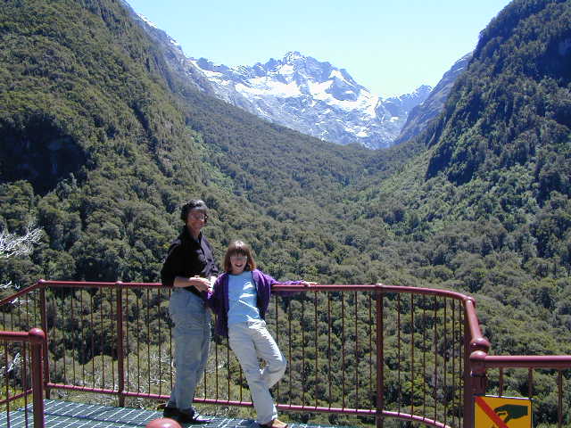
Here you see Jennifer and Stephanie at an overlook while on our way to Milford
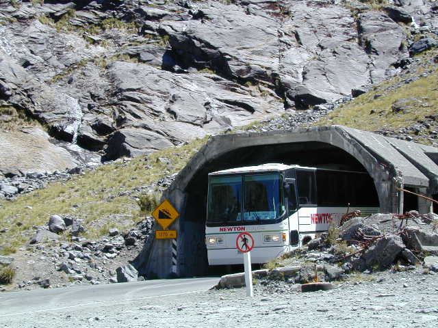
Sound showing the very rugged Southern Alps. The next picture is from the
valley of one of the many u-shaped gorges carved by retreating glaciers from 10,000 to 14,000
years ago. As you can see, building a road all the way up and over the top
would be impossible, so a tunnel takes you through the solid granite
mountain. You see a bus emerging from the rather narrow long steep tunnel.
The tunnel actually descends as you go through it and you come out some 700
meters lower on the west side.
Back to Top
Milford
Sound
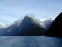
In Milford Sound shown here, you get a sense of just how steep
the mountains are as they rise out of the water. The famous Milford
Track hiking (tramping) trail ends here. We went on an overnight boat trip
that explored the fiord, departing in the evening and returning the next morning.
This permitted another opportunity to do some sea kayaking off the boat before
dinner. The early Europeans' named them sounds in error, and it has stuck.
A sound is
caused by a river, while a fiord is caused by glaciers as
these were.
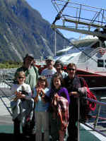
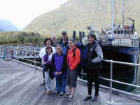
One of the great things about our Odyssey is that we are
getting to meet some really great people. Stephanie especially enjoys it when they also have 10 year old girls to play with and share our
experiences. The next two pictures show us with two Australian
families sharing our trip: The first is the Coombs family,
Terry, Jenny and daughters Kendall and Allie. The Ross Family includes
Ian, Anne and daughters Emily and Katie.
Back to Top
Doubtful
Sound
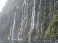
Two days later and in a lot of rain, we found ourselves in
Doubtful Sound, named by Captain James Cook when he was mapping New
Zealand. He decided not to turn into the fiord because
he was 'doubtful' that he could catch a favorable wind to turn his ship around later. Actually, Doubtful
Sound is much larger than Milford Sound and the other sounds or fiords in
Fiordland. Because of the rain, you experience many, many more
waterfalls than you normally see from normal stream runoff. The first
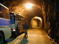
picture shows an entire wall of water running off the granite wall. To reach Doubtful Sound, you first travel via boat across Lake
Manapouri, just
south of Lake Te Anau. At that point, you get on a bus that takes you over
a steep pass (20% grade!!) built to allow the construction of a large power
plant. On this trip, they take you down into the power plant, which is
located in the mountain. The picture is taken at the end of the 2 km
tunnel which leads to the generators. The big buses have to turn around in the
tunnel in a space that leaves them only a few inches to maneuver between the
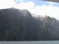
rock walls. If you click on the last picture, you can clearly see the new
snow fall on the tops of the mountains adjoining Lake Manapouri (about
1,000 meters). It was definitely not summer weather while we were visiting
Doubtful Sound! If you look closely, you
can see a few bare spots on the cliffs showing only rock and no green growth.
These spots are caused when a portion of the overgrowth loses its hold on the
rock and starts an avalanche of the green foliage, leaving the bare rock
surfaces. Then, nature starts the re-growth process first with lichens,
then moss, and finally, grass and bush.
Back to Top
Routeburn
Track
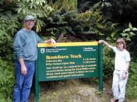
Stephanie and Denny stand
beside a DOC sign (Department of Conservation, like the US National Park Service
and Department of Interior rolled into one) noting the start of one of the famous New Zealand hiking (or in NZ
terms, tramping) tracks, the Routeburn Track. While we did not hike the
entire 3-day track, we did go to the summit of the first pass and to the first
hut. The Routeburn and the more famous Milford Track are in the middle of
the huge Fiordland National Park, and we would like to tackle at least one when we return someday
soon, albeit after spending time
to get in better shape! The tracks are well maintained with covered
culverts and trenches along the side to keep the walking track free of mud from the
rain.
Back to Top
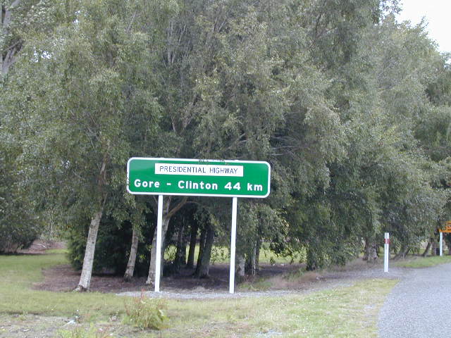
Gore-Clinton

On our way to Dunedin we passed through the town of Gore. The next
town down the road is named
Clinton. If you click on this picture, you can see the distance from Gore
to Clinton is 44 km and they have dubbed this the Presidential Highway. On
that note, we looked in our travel books to see if there was a town named Bush
or Cheney. No such luck, so it looks like Gore - Clinton have the lock on
at least the Presidential Highway for now. In any case, the people here and
certainly the press like Clinton a lot -- in part because he actually
came to their country to visit!!
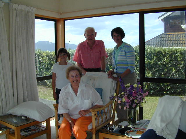
We are now enjoying a multi-day family reunion in
Dunedin with Jennifer's US, NZ, UK and Portuguese families well represented. We will
update you again after we finish traveling in New Zealand and tour
Australia for a while. New Zealand is a great place - much like
Colorado, only much greener, with huge rugged mountains and an ocean all around. We will be back
here sometime in the not too distant future. We are,
however, looking forward to some warmer weather when we
arrive in Sydney --though something less than the current 40 degrees C would be
nice!!
Thanks for sharing our memories and travels.
Send
email any time if you any questions or comments about the Rich
Family Odyssey.
Back to Top